Fahrenbach - Muelben
Airport details
| Country | Germany |
| State | Baden-Württemberg |
| Region | |
| Airspace | Langen Ctr |
| Municipality | Waldbrunn |
| Elevation | 1688ft (515m) |
| Timezone | GMT +1 |
| Coordinates | 49.45601, 9.10311 |
| Magnetic var | |
| Type | land |
| Available since | X-Plane v10.40 |
| ICAO code | XEDEF |
| IATA code | n/a |
| FAA code | n/a |
Communication
| Muelben Muelben Anflug | 134.965 |
Nearby Points of Interest:
Limeswachturm Wp 10/59
-Alte katholische Kirche Lohrbach
-Jagdschloss Gammelsbach
-Haus Mosbacher Straße 3
-Schloss Hochhausen
-Stellsteinreihe
-Krähbergtunnel
-Watterbacher Haus
-Zehntscheune (Buchen im Odenwald)
-Synagogue (Sennfeld)
-Olfener Bild
-Rathaus
-Altes Pfarrhaus (Eschelbronn)
-Burg Frankenberg
-Habermannsburg
-Burgmannenhaus Pavey
-Grabkapelle der Freiherren von Ellrichshausen
-Saint Luke Church
-Friedhof Michelstadt
-Jagdschloß Eulbach
-Lindenplatz 5
-Marktplatz 6
-Alte Brauerei
-Rathaus Michelstadt
-Holy Trinity Chapel
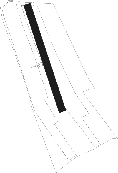
Runway info
| Runway 16 / 34 | ||
| length | 525m (1722ft) | |
| bearing | 159° / 339° | |
| width | 35m (114ft) | |
| surface | grass | |
Nearby beacons
| code | identifier | dist | bearing | frequency |
|---|---|---|---|---|
| NKR | NECKAR NDB | 16.1 | 252° | 292 |
| MND | DME | 22.9 | 271° | 113.55 |
| CHA | CHARLIE VOR/DME | 28 | 352° | 115.35 |
| RID | RIED VOR/DME | 29.3 | 300° | 112.20 |
| SHD | HALL DME | 33.3 | 117° | 108.05 |
| NDD | DME-ILS | 33.7 | 94° | 108.70 |
| NSN | NIEDERSTETTEN NDB | 33.8 | 94° | 311 |
| LBU | LUBURG VOR/DME | 33.9 | 156° | 109.20 |
| KRH | KARLSRUHE VOR/DME | 34.4 | 228° | 115.95 |
| VFM | NAUHEIM VOR | 39 | 309° | 113.75 |
| FR | FRANKFURT NDB | 40 | 325° | 297 |
| FFM | FRANKFURT VORTAC | 40.1 | 322° | 114.20 |
| FRD | DME | 40.2 | 317° | 115.90 |
| FW | FRANKFURT NDB | 42 | 309° | 382 |
| STG | STUTTGART VOR/DME | 46 | 169° | 116.85 |
| SGD | DME | 46.3 | 171° | 115.45 |
| WIB | WIESBADEN TACAN | 46.9 | 307° | 114.10 |
| MTR | METRO VOR | 50.2 | 343° | 110 |
| TGO | TANGO TACAN | 50.6 | 169° | 112.50 |
| GED | GEDERN VORTAC | 57.6 | 9° | 110.80 |
| TAU | TAUNUS VOR/DME | 60 | 310° | 113.35 |
Disclaimer
The information on this website is not for real aviation. Use this data with the X-Plane flight simulator only! Data taken with kind consent from X-Plane 12 source code and data files. Content is subject to change without notice.