Neuruppin
Airport details
| Country | Germany |
| State | Brandenburg |
| Region | |
| Airspace | Bremen Ctr |
| Municipality | Neuruppin |
| Elevation | 141ft (43m) |
| Timezone | GMT +1 |
| Coordinates | 52.94291, 12.77987 |
| Magnetic var | |
| Type | land |
| Available since | X-Plane v10.40 |
| ICAO code | XEDEN |
| IATA code | n/a |
| FAA code | n/a |
Communication
| Neuruppin Neuruppin Segelflug | 132.740 |
Nearby Points of Interest:
Gord of Ruppin
-Ruppiner Kliniken
-Ruppin Castle
-Pfarrkirche St. Nikolai
-Village church Dabergotz
-Dorfkirche Gottberg
-Village church Lichtenberg (Neuruppin)
-Gut Buskow
-Village church Karwe
-Village church Kerzlin
-Village church Langen (Fehrbellin)
-Village church Kantow
-Burgwall Wildberg (Temnitztal)
-Wustrau church
-Herzberg church
-Parish church Lindow in der Mark
-Village church Keller
-Village church Rossow
-Village church Rönnebeck
-Village church Brunne
-Village church Schulzendorf (Sonnenberg)
-Village church Dechtow
-Burgwall von Linum
-St. Peter and Paul Wusterhausen
-Hellmuth Ulrici Clinic
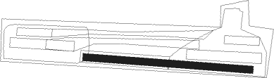
Runway info
| Runway 09 / 27 | ||
| length | 788m (2585ft) | |
| bearing | 95° / 275° | |
| width | 34m (113ft) | |
| surface | grass | |
Nearby beacons
| code | identifier | dist | bearing | frequency |
|---|---|---|---|---|
| LWB | LOEWENBERG VOR/DME | 12.9 | 95° | 114.55 |
| SDD | DME | 43.1 | 128° | 114.40 |
| BBI | BERLIN BRANDENBURG VOR/DME | 43.6 | 132° | 114.10 |
| PI | SCHWERIN-PARCHIM NDB | 44.2 | 301° | 333 |
| PMD | DME | 46 | 296° | 117.50 |
| FLD | FRIEDLAND VOR/DME | 56.6 | 44° | 117.15 |
| LAG | LAAGE TACAN | 61.2 | 333° | 108.25 |
| KLF | KLASDORF VOR/DME | 62.4 | 140° | 115.15 |
| MAG | MAGDEBURG VOR/DME | 67.3 | 226° | 110.45 |
Disclaimer
The information on this website is not for real aviation. Use this data with the X-Plane flight simulator only! Data taken with kind consent from X-Plane 12 source code and data files. Content is subject to change without notice.