Obertraubling - Oberhinkhofen
Airport details
| Country | Germany |
| State | Bavaria |
| Region | |
| Airspace | Munich Ctr |
| Municipality | Obertraubling |
| Elevation | 1270ft (387m) |
| Timezone | GMT +1 |
| Coordinates | 48.95119, 12.14786 |
| Magnetic var | |
| Type | land |
| Available since | X-Plane v10.40 |
| ICAO code | XEDEP |
| IATA code | n/a |
| FAA code | n/a |
Communication
| Oberhinkhofen Oberhinkhofen Info | 133.260 |
Nearby Points of Interest:
Burg Traubling
-Burgstall Luckenpaint
-Burg Graß
-Schloss Barbing
-Städtisches Gaswerk Regensburg
-Evangelischer Zentralfriedhof
-Saint John the Baptist Church (Pentling)
-Burg Abbach
-St. Emmeram's Palace
-St. Emmeram's Abbey
-Alte Dechantei
-Basilica of the Nativity of Our Lady, Regensburg
-Justizvollzugsanstalt Regensburg
-Augustinerkloster Regensburg
-Hauptwache Regensburg
-Ehemalige Salvatorkapelle, anstelle der abgebrochenen Kreuzkapelle des ehemaligen Augustinerklosters
-Cultural heritage monuments in Regensburg: Fürst-Anselm-Allee
-Baumburger Turm
-Neue Waag (Regensburg)
-Salzstadel
-Brückstraße 2, Ehem. Amberger Stadel (Regensburg)
-Weinschänk-Villa
-Theater Regensburg
-Eiserner Steg
-St. Michael (Regensburg)
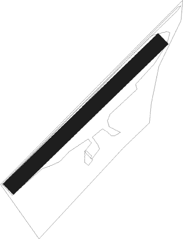
Runway info
| Runway 04 / 22 | ||
| length | 544m (1785ft) | |
| bearing | 61° / 241° | |
| width | 40m (132ft) | |
| surface | grass | |
Nearby beacons
| code | identifier | dist | bearing | frequency |
|---|---|---|---|---|
| RDG | RODING VOR/DME | 15.8 | 77° | 114.70 |
| HFX | HOHENFELS NDB | 19.6 | 313° | 286 |
| IGL | INGOLSTADT NDB | 23.6 | 247° | 345 |
| IGL | INGOLSTADT TACAN | 26.8 | 248° | 111.40 |
| MIQ | MIKE NDB | 31.5 | 235° | 426 |
| MNW | MUNICH NDB | 35.8 | 202° | 338 |
| MSW | MUNICH NDB | 37.2 | 202° | 400 |
| DMN | DME | 37.7 | 211° | 116 |
| DMS | DME | 39.4 | 211° | 115 |
| NEU | NEUBURG TACAN | 39.7 | 256° | 108.90 |
| MNE | MUNICH NDB | 40.3 | 218° | 369 |
| MSE | MUNICH NDB | 41.9 | 219° | 358 |
| GRF | GRAFENWOHR TACAN | 45.1 | 344° | 111.80 |
| GRW | GRAFENWOHR NDB | 45.3 | 345° | 405 |
| RTB | ROETHENBACH NDB | 47.4 | 301° | 415 |
| OTT | OTTERSBERG VOR/DME | 48.1 | 203° | 112.30 |
| MAH | MAISACH VOR/DME | 52.9 | 231° | 115.20 |
| ERL | ERLANGEN VOR/DME | 57.5 | 305° | 114.90 |
| OBI | OBERPFAFFENHOFEN NDB | 62.5 | 225° | 429 |
| SBG | SALZBURG VOR/DME | 64.2 | 142° | 113.80 |
| SBG | SALZBURG NDB | 66.1 | 143° | 382 |
Disclaimer
The information on this website is not for real aviation. Use this data with the X-Plane flight simulator only! Data taken with kind consent from X-Plane 12 source code and data files. Content is subject to change without notice.