Oeventrop-ruhrwiesen
Airport details
| Country | Germany |
| State | North Rhine-Westphalia |
| Region | |
| Airspace | Langen Ctr |
| Municipality | Arnsberg |
| Elevation | 689ft (210m) |
| Timezone | GMT +1 |
| Coordinates | 51.39769, 8.14222 |
| Magnetic var | |
| Type | land |
| Available since | X-Plane v10.40 |
| ICAO code | XEDES |
| IATA code | n/a |
| FAA code | n/a |
Communication
Nearby Points of Interest:
Marienhospital Arnsberg
-Landgericht Arnsberg
-Groten-Turm
-Haus Zur Krim
-Stockhausenhaus
-Altes Rathaus Arnsberg
-Dückerscher Hof
-Husemann House
-Amtsgericht Arnsberg
-Zivilkasino Arnsberg
-Haus Schennen
-Haus Niederberge
-Gut Stockhausen (Meschede)
-Dominikanerinnenkloster Galiläa, Meschede
-Meschede-Schüren Airport
-Villa Westermann
-Altes Amtsgericht Neheim
-Saint Anthony of Padua Church
-St. Jakobus d. Ä.
-Leiden Christi (Stockum)
-Kapelle zu den 14 Nothelfern (Remblinghausen)
-St. Elisabeth
-Jüdischer Friedhof
-Gutskapelle St. Antonius
-Pfarrhaus (Voßwinkel)
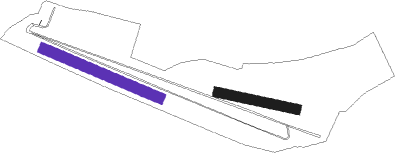
Runway info
| Runway 12 / 30 | ||
| length | 444m (1457ft) | |
| bearing | 108° / 288° | |
| width | 37m (120ft) | |
| surface | grass | |
Runway 11 / 29  | ||
| length | 282m (925ft) | |
| bearing | 100° / 280° | |
| width | 36m (117ft) | |
| surface | grass | |
Nearby beacons
| code | identifier | dist | bearing | frequency |
|---|---|---|---|---|
| GMH | GERMINGHAUSEN VOR/DME | 16.5 | 228° | 115.40 |
| DWI | DORTMUND-WICKEDE NDB | 20.5 | 284° | 357 |
| DOR | WICKEDE (DORTMUND) VOR/DME | 20.6 | 284° | 108.65 |
| PAD | DME-ILS | 21.9 | 66° | 108.50 |
| PAD | PADERBORN-LIPPSTADT NDB | 23 | 66° | 354 |
| HMM | HAMM VOR/DME | 31.9 | 317° | 115.65 |
| BAM | BARMEN VOR/DME | 36.4 | 266° | 114 |
| WRB | WARBURG VOR/DME | 36.8 | 84° | 113.70 |
| WYP | WIPPER VOR | 38.6 | 248° | 109.60 |
| SLD | DME | 41.5 | 185° | 108.05 |
| COL | COLA VOR/DME | 42.2 | 222° | 108.80 |
| SIL | SIEGERLAND NDB | 43.1 | 180° | 489 |
| LW | COLOGNE-BONN NDB | 44.9 | 241° | 300 |
| MYN | MUENSTER/OSNABRUECK NDB | 47.4 | 336° | 371 |
| MOD | DME | 47.5 | 328° | 114.05 |
| OSB | OSNABRUCK TACAN | 48.4 | 10° | 108.35 |
| OSN | OSNABRUECK VOR | 48.4 | 10° | 114.30 |
| LV | COLOGNE-BONN NDB | 49.2 | 237° | 327 |
| KBO | COLOGNE-BONN VOR/DME | 49.4 | 242° | 112.15 |
| BYC | BUECKEBURG NDB | 64.1 | 47° | 368 |
Disclaimer
The information on this website is not for real aviation. Use this data with the X-Plane flight simulator only! Data taken with kind consent from X-Plane 12 source code and data files. Content is subject to change without notice.