Perleberg
Airport details
| Country | Germany |
| State | Brandenburg |
| Region | |
| Airspace | Bremen Ctr |
| Municipality | Perleberg |
| Elevation | 98ft (30m) |
| Timezone | GMT +1 |
| Coordinates | 53.06740, 11.81395 |
| Magnetic var | |
| Type | land |
| Available since | X-Plane v10.40 |
| ICAO code | XEDEZ |
| IATA code | n/a |
| FAA code | n/a |
Communication
Nearby Points of Interest:
Amtsgericht Perleberg
-Town hall in Perleberg
-Großer Markt 4 (Perleberg)
-Großer Markt 16
-Jüdischer Friedhof
-Town hall in Wittenberge
-Alte Ölmühle zu Wittenberge
-Village church Hinzdorf
-Breite Straße 7, 7a
-Saint Nikolaus Church (Beuster)
-Pfarrhaus Groß Beuster
-Protestant Church Vielbaum
-Kirche Kapern
-St. Petri (Seehausen)
-Klein Warnow station
-St. Georg
-Philippshof
-Townhall Pritzwalk
-Tuchfabrik Draeger
-Dorfkirche Dobbrun
-Village church in Nitzow
-Burgwall von Meetschow
-Village church Preddöhl
-Protestant Church (Königsmark)
-Church in Marnitz
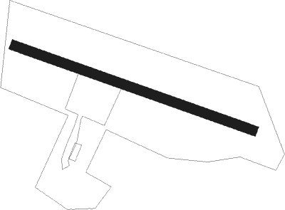
Runway info
| Runway 11 / 29 | ||
| length | 1407m (4616ft) | |
| bearing | 105° / 285° | |
| width | 56m (183ft) | |
| surface | grass | |
| displ threshold | 145m (476ft) / 151m (495ft) | |
Nearby beacons
| code | identifier | dist | bearing | frequency |
|---|---|---|---|---|
| BKD | BRUENKENDORF VOR/DME | 9.8 | 263° | 117.70 |
| PAH | SCHWERIN-PARCHIM NDB | 20.3 | 336° | 315 |
| PMD | DME | 21.5 | 355° | 117.50 |
| PI | SCHWERIN-PARCHIM NDB | 23.8 | 13° | 333 |
| LAG | LAAGE TACAN | 53.9 | 29° | 108.25 |
Disclaimer
The information on this website is not for real aviation. Use this data with the X-Plane flight simulator only! Data taken with kind consent from X-Plane 12 source code and data files. Content is subject to change without notice.