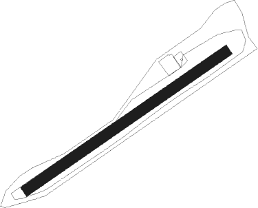
Utscheid
Airport details
| Country | Germany |
| State | Rhineland-Palatinate |
| Region | |
| Airspace | Langen Ctr |
| Municipality | Utscheid |
| Elevation | 1391ft (424m) |
| Timezone | GMT +1 |
| Coordinates | 49.99815, 6.34382 |
| Magnetic var | |
| Type | land |
| Available since | X-Plane v10.40 |
| ICAO code | XEDF1 |
| IATA code | n/a |
| FAA code | n/a |
Communication
| Utscheid Utscheid Info | 131.010 |
Runway info
| Runway 05 / 23 | ||
| length | 801m (2628ft) | |
| bearing | 69° / 249° | |
| width | 35m (115ft) | |
| surface | grass | |
| blast zone | 0m (0ft) / 50m (164ft) | |
Nearby beacons
| code | identifier | dist | bearing | frequency |
|---|---|---|---|---|
| DIK | DIEKIRCH NDB | 11.6 | 237° | 307 |
| SPA | SPANGDAHLEM TACAN | 13.7 | 93° | 109.50 |
| ELU | LUXEMBOURG NDB | 19.1 | 178° | 368 |
| LE | LUXEMBOURG NDB | 21.8 | 195° | 318 |
| LUX | LUXEMBOURG VOR/DME | 21.8 | 195° | 112.25 |
| LW | LUXEMBOURG NDB | 24 | 204° | 404 |
| WLU | LUXEMBOURG NDB | 28.1 | 214° | 346 |
| BUE | BUECHEL TACAN | 29.9 | 76° | 117.10 |
| SLV | SPA NDB | 33.2 | 318° | 386 |
| FHH | DME | 35.5 | 94° | 117.35 |
| HAN | HAHN NDB | 36.2 | 92° | 376 |
| SPI | SPRIMONT VOR/DME | 41.5 | 306° | 113.10 |
| LNO | OLNO VOR/DME | 42.8 | 313° | 112.80 |
| MTZ | METZ NDB | 43.6 | 191° | 354 |
| NVO | NOERVENICH VORTAC | 50.7 | 20° | 116.20 |
| LGE | LIEGE VOR/DME | 51.6 | 307° | 115.45 |
| WNN | DME | 51.8 | 21° | 109.85 |
| ONL | LIEGE NDB | 52 | 311° | 290 |
| ETN | ETAIN NDB | 53 | 221° | 410 |
| SAD | DME | 55.9 | 135° | 116.75 |
| SR | ENSHEIM (SAARBRUECKEN) NDB | 57.9 | 132° | 360 |
| GIX | GEILENKIRCHEN TACAN | 59 | 343° | 108.10 |
| LV | COLOGNE-BONN NDB | 59.3 | 48° | 327 |
| LOU | LORRAINE NDB | 60.1 | 184° | 388 |
| KBO | COLOGNE-BONN VOR/DME | 60.2 | 43° | 112.15 |
| MAS | MAASTRICHT VOR/DME | 60.2 | 339° | 108.60 |
| LJ | COLOGNE-BONN NDB | 62.1 | 38° | 365 |
| LW | COLOGNE-BONN NDB | 64.2 | 45° | 300 |
Disclaimer
The information on this website is not for real aviation. Use this data with the X-Plane flight simulator only! Data taken with kind consent from X-Plane 12 source code and data files. Content is subject to change without notice.
