Oberstenfeld - Voelkleshofen Lichtenberg
Airport details
| Country | Germany |
| State | Baden-Württemberg |
| Region | |
| Airspace | Langen Ctr |
| Municipality | Oberstenfeld |
| Elevation | 1291ft (393m) |
| Timezone | GMT +1 |
| Coordinates | 49.01057, 9.35421 |
| Magnetic var | |
| Type | land |
| Available since | X-Plane v10.40 |
| ICAO code | XEDF5 |
| IATA code | n/a |
| FAA code | n/a |
Communication
| Voelkleshofen Lichtenberg Voelkleshofen Info | 119.610 |
Nearby Points of Interest:
Unteres Schloss (Beilstein)
-Backnanger Stadthaus
-Schloss Backnang
-Haller Straße 3
-Rathaus Ottmarsheim
-Pleidelsheim power station
-Gasthaus zum Adler
-Doppelt versteinte Hällische Straße
-Lämlinhaus
-Kornhaus, Flein
-Oberes Schloss (Talheim)
-Fischerhaus, Flein
-Altes Rathaus, Flein
-Gasthaus zum Ochsen (Eschenau)
-Kastelle von Walheim
-Unteres Schloss
-Burgmal
-Katharinenstift
-Schloss Winnental
-Alte Kelter
-Cäcilienbrunnen
-Villa Fuchs (Heilbronn)
-Baukelter Weinsberg
-Schmollerstraße 64 (Heilbronn)
-Villa Kleinbach
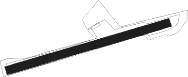
Runway info
| Runway 08 / 26 | ||
| length | 789m (2589ft) | |
| bearing | 82° / 262° | |
| width | 41m (133ft) | |
| surface | grass | |
Nearby beacons
| code | identifier | dist | bearing | frequency |
|---|---|---|---|---|
| LBU | LUBURG VOR/DME | 5.8 | 188° | 109.20 |
| SHD | HALL DME | 17.8 | 76° | 108.05 |
| STG | STUTTGART VOR/DME | 19.2 | 197° | 116.85 |
| SGD | DME | 20 | 202° | 115.45 |
| TGO | TANGO TACAN | 23.8 | 194° | 112.50 |
| KRH | KARLSRUHE VOR/DME | 30.3 | 269° | 115.95 |
| NKR | NECKAR NDB | 31.2 | 298° | 292 |
| NDD | DME-ILS | 33 | 58° | 108.70 |
| NSN | NIEDERSTETTEN NDB | 33.2 | 58° | 311 |
| DKB | DINKELSBUEHL VORTAC | 35.6 | 81° | 117.80 |
| MND | DME | 42.9 | 299° | 113.55 |
| SUL | SULZ VOR | 47 | 228° | 116.10 |
| LUP | LAUPHEIM NDB | 52.4 | 145° | 407 |
| CHA | CHARLIE VOR/DME | 56 | 341° | 115.35 |
| RID | RIED VOR/DME | 56.1 | 313° | 112.20 |
| VFM | NAUHEIM VOR | 66.7 | 317° | 113.75 |
| FW | FRANKFURT NDB | 69.7 | 317° | 382 |
Disclaimer
The information on this website is not for real aviation. Use this data with the X-Plane flight simulator only! Data taken with kind consent from X-Plane 12 source code and data files. Content is subject to change without notice.