Airports for X-Plane offers a convenient way to explore airports and their related communication information for the X-Plane flight simulator. It only uses data from the X-Plane flight simulator itself, and is therefore more reliable than the data that comes from real aviation websites. You can search for airports by using the ICAO code, or browse for airports per country and state. The information displayed is categorized by airport details, runway information, airport communication, approach frequencies (ILS and Glidepath details), details of nearby beacons, SIDs, STARs and approach procedures.

plane airline embassy aircraft luggage customs newark airspace immigration air terminal faa landing area airport apron buildings gravel capital regional airfield traffic pattern airdrome airplane

Eschwege - Eschwege Stauffenbuehl

Airport details

CountryGermany
StateHesse
Region
AirspaceLangen Ctr
MunicipalityEschwege
Elevation853ft (260m)
TimezoneGMT +1
Coordinates51.15542, 10.04541
Magnetic var
Typeland
Available sinceX-Plane v10.40
ICAO codeXEDFM
IATA coden/a
FAA coden/a

Communication

Eschwege Stauffenbuehl Stauffenbühl-Start125.490
Nearby Points of Interest:
Synagoge (Eschwege)
-
Evangelische Pfarrkirche Datterode
-
Lehnhaus
-
Bahnhof Eschwege West
-
Bahnhof Schwebda
-
Gesegneter Born bei Albungen
-
Evangelische Kirche Albungen
-
Evangelische Stadtkirche (Wanfried)
-
Wanfried town hall
-
Ehemalige evangelische Kirche Abterode
-
Synagoge Abterode
-
Evangelische Kirche in Mitterode
-
Gut Keudelstein
-
Evangelische Stadtkirche
-
St.-Johannes-Kirche
-
Gefängnis
-
Wohnturm Berneburg
-
Evangelische Kirche Mönchhosbach
-
Saint Mary Church (Heyerode)
-
Evangelische Kirche Hundelshausen
-
Kirche (Göringen)
-
Schloss Neuenhof (Eisenach)
-
Gasteroda
-
Jüdischer Friedhof Heilbad Heiligenstadt
-
Kirche Hollenbach

Runway info

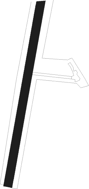
Runway 01 / 19
 length851m (2792ft)
 bearing22° / 202°
 width40m (131ft)
 surfacegrass

Airport layout


Parking locations

Nearby beacons

codeidentifierdistbearingfrequency
FTZFRITZLAR NDB24.1264°468
DKSDME-ILS28.8293°111.50
EFDDME35.9101°112.05
FULFULDA VOR/DME38.2220°112.10
WRBWARBURG VOR/DME40.8291°113.70
GEDGEDERN VORTAC53.9227°110.80

Disclaimer

The information on this website is not for real aviation. Use this data with the X-Plane flight simulator only! Data taken with kind consent from X-Plane 12 source code and data files. Content is subject to change without notice.