Boerger - Flugplatz Steinberg Surwold
Airport details
| Country | Germany |
| State | Lower Saxony |
| Region | |
| Airspace | Bremen Ctr |
| Municipality | Surwold |
| Elevation | 0ft (0m) |
| Timezone | GMT +1 |
| Coordinates | 52.95820, 7.55563 |
| Magnetic var | |
| Type | land |
| Available since | X-Plane v10.40 |
| ICAO code | XEDFN |
| IATA code | n/a |
| FAA code | n/a |
Communication
| Flugplatz Steinberg Surwold ATC | 127.540 |
Nearby Points of Interest:
Ludmillenhof
-St. Petrus in Ketten
-St. Nikolaus
-Dreifaltigkeitskirche (Collinghorst)
-Vellager Kirche
-Mitling-Marker Kirche
-Reformierte Kirche
-Stapelmoorer Kirche
-St. Laurentius und St.Vincentius (Backemoor)
-St. Johannes Baptist (Grotegaste)
-St. Cosmas und Damian (Barßel)
-Holthuser Kirche
-Organeum
-St. Joseph
-Kerk van Sellingen
-Village church Kirchborgum
-Esklumer Kirche
-Leerort
-Rathaus Leer
-Amtsgericht Leer
-Harderwykenburg
-Rechthuis
-Church of Vriescheloo
-Logabirumer Kirche
-Historischer Garten Tammen in Bunderhee
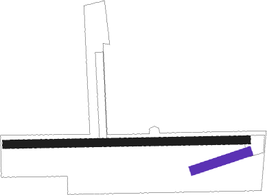
Runway info
| Runway 07 / 25 | ||
| length | 232m (761ft) | |
| bearing | 81° / 261° | |
| width | 39m (127ft) | |
| surface | grass | |
Runway 09 / 27  | ||
| length | 1001m (3284ft) | |
| bearing | 92° / 272° | |
| width | 34m (112ft) | |
| surface | grass | |
| displ threshold | 100m (328ft) / 0m (0ft) | |
Nearby beacons
| code | identifier | dist | bearing | frequency |
|---|---|---|---|---|
| EEL | EELDE (GRONINGEN) VOR/DME | 34.3 | 283° | 112.40 |
| WTM | WITTMUNDHAFEN TACAN | 36.3 | 16° | 113.50 |
| DP | DIEPHOLZ NDB | 39.3 | 112° | 325 |
| MYN | MUENSTER/OSNABRUECK NDB | 48.8 | 163° | 371 |
| MOD | DME | 49.4 | 171° | 114.05 |
| OSB | OSNABRUCK TACAN | 52.7 | 136° | 108.35 |
| OSN | OSNABRUECK VOR | 52.7 | 136° | 114.30 |
| RKN | DME | 57.3 | 224° | 116.80 |
Disclaimer
The information on this website is not for real aviation. Use this data with the X-Plane flight simulator only! Data taken with kind consent from X-Plane 12 source code and data files. Content is subject to change without notice.