Stolberg - Diepenlinchen
Airport details
| Country | Germany |
| State | North Rhine-Westphalia |
| Region | |
| Airspace | Langen Ctr |
| Municipality | Stolberg |
| Elevation | 853ft (260m) |
| Timezone | GMT +1 |
| Coordinates | 50.76947, 6.28104 |
| Magnetic var | |
| Type | land |
| Available since | X-Plane v11.55 |
| ICAO code | XEDFP |
| IATA code | n/a |
| FAA code | n/a |
Communication
| Diepenlinchen Diepenlinchen Info | 120.290 |
Nearby Points of Interest:
Gressenicher Mühle
-Eschweiler Wald
-Kupferhof Rose
-Eagle-Pharmacy
-Kupferhof Schart
-Kupferhof Enkerei
-Kupferhof Bauschenberg
-Dollartshammer
-Kupferhof Stöck
-Kupferhof Unterster Hof
-Jüdischer Friedhof (Langerwehe)
-Amtsgericht Eschweiler
-Kupferhof Gedau
-Alte Dorffer Linde
-Haus Palant
-Broicher Hof
-Drimbornshof
-Nirmer Mühle
-Pannhaus
-Haus Lützeler
-Jüdischer Friedhof
-Agathastraße 92
-Haus Gronau
-Mona-Lisa-Turm
-Saint Pancratius Chapel
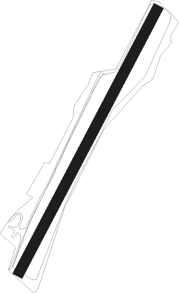
Runway info
| Runway 03 / 21 | ||
| length | 892m (2927ft) | |
| bearing | 45° / 225° | |
| width | 32m (104ft) | |
| surface | grass | |
Nearby beacons
| code | identifier | dist | bearing | frequency |
|---|---|---|---|---|
| NVO | NOERVENICH VORTAC | 13.8 | 81° | 116.20 |
| GIX | GEILENKIRCHEN TACAN | 14.6 | 309° | 108.10 |
| WNN | DME | 15.2 | 80° | 109.85 |
| MAS | MAASTRICHT VOR/DME | 17.1 | 302° | 108.60 |
| NW | MAASTRICHT NDB | 21.3 | 302° | 373 |
| SLV | SPA NDB | 22.4 | 232° | 386 |
| LNO | OLNO VOR/DME | 24.3 | 252° | 112.80 |
| ONL | LIEGE NDB | 28.1 | 265° | 290 |
| MHD | DME | 29 | 24° | 112.50 |
| MHV | MOENCHENGLADBACH VOR | 29.1 | 24° | 109.80 |
| SPI | SPRIMONT VOR/DME | 29.3 | 249° | 113.10 |
| LJ | COLOGNE-BONN NDB | 31 | 79° | 365 |
| DY | DUESSELDORF NDB | 31.2 | 39° | 284 |
| LGE | LIEGE VOR/DME | 31.5 | 262° | 115.45 |
| KBO | COLOGNE-BONN VOR/DME | 33.2 | 84° | 112.15 |
| DUS | DUESSELDORF VOR/DME | 35.6 | 43° | 115.15 |
| LMA | LIMA NDB | 36.3 | 11° | 311 |
| LV | COLOGNE-BONN NDB | 36.4 | 88° | 327 |
| LW | COLOGNE-BONN NDB | 37.6 | 82° | 300 |
| BBL | KLEINE BROGEL TACAN | 39 | 296° | 109.60 |
| WYP | WIPPER VOR | 41.3 | 74° | 109.60 |
| LI | DUESSELDORF NDB | 41.6 | 47° | 417 |
| BUE | BUECHEL TACAN | 46.5 | 127° | 117.10 |
| BAM | BARMEN VOR/DME | 47.6 | 58° | 114 |
| SPA | SPANGDAHLEM TACAN | 50 | 152° | 109.50 |
| LAA | NIEDERRHEIN NDB | 50.1 | 353° | 352 |
| NID | DME | 50.1 | 350° | 115.50 |
| EHV | EINDHOVEN TACAN | 53.1 | 307° | 117.20 |
| DIK | DIEKIRCH NDB | 54.8 | 189° | 307 |
| BOT | BOTTROP NDB | 56.4 | 42° | 406 |
| VKL | VOLKEL TACAN | 57.4 | 327° | 108.30 |
| HAN | HAHN NDB | 61.6 | 129° | 376 |
| FHH | DME | 62.2 | 130° | 117.35 |
Disclaimer
The information on this website is not for real aviation. Use this data with the X-Plane flight simulator only! Data taken with kind consent from X-Plane 12 source code and data files. Content is subject to change without notice.