Westertimke - Tarmstedt
Airport details
| Country | Germany |
| State | Lower Saxony |
| Region | |
| Airspace | Bremen Ctr |
| Municipality | Westertimke |
| Elevation | 129ft (39m) |
| Timezone | GMT +1 |
| Coordinates | 53.25188, 9.11430 |
| Magnetic var | |
| Type | land |
| Available since | X-Plane v10.40 |
| ICAO code | XEDFS |
| IATA code | n/a |
| FAA code | n/a |
Communication
Nearby Points of Interest:
Wassermühle Bademühlen
-Alte Posthalterei
-St. Margarethen (Gyhum)
-Burg Clüversborstel
-Christophorus-Kirche
-Stalag X-B
-St.-Marien-Kirche (Trupe)
-Wikingborg
-Wohnhaus Oberneulander Landstraße 141A
-Haus Schumacher
-Landhaus Böving
-Haus Hoogenkamp
-Landsitz Caesar-Ichon
-Haus Weyhausen
-Brinksitzerhaus
-Gaststätte Meyer am Boom
-Wohnhaus Lindenweg 12
-Schmiede Oberneuland und Wohnhaus
-Landhaus Waldthausen
-Landgut Arndt-Soltmann
-Haus Weltmann
-Landsitz Hasse
-Villa Leupold
-Landhaus Louisenthal
-Egestorff Foundation
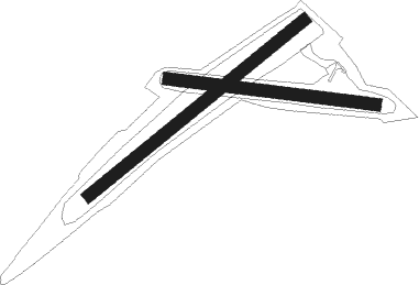
Runway info
Runway 06 / 24  | ||
| length | 746m (2448ft) | |
| bearing | 68° / 248° | |
| width | 33m (108ft) | |
| surface | grass | |
| Runway 10 / 28 | ||
| length | 560m (1837ft) | |
| bearing | 97° / 277° | |
| width | 33m (108ft) | |
| surface | grass | |
Nearby beacons
| code | identifier | dist | bearing | frequency |
|---|---|---|---|---|
| WSN | WESER NDB | 10.3 | 292° | 378 |
| HIG | BREMEN NDB | 14.2 | 225° | 318 |
| BND | DME | 17.2 | 238° | 113.65 |
| BMN | BREMEN VOR/DME | 17.7 | 240° | 117.45 |
| NDO | NORDHOLZ NDB | 33.8 | 330° | 372 |
| NDO | NORDHOLZ TACAN | 35.1 | 318° | 117.10 |
| NIE | NIENBURG VOR | 38.7 | 158° | 116.50 |
| ALF | DME | 38.9 | 66° | 115.80 |
| DP | DIEPHOLZ NDB | 46.3 | 225° | 325 |
| WUN | WUNSTORF TACAN | 49.2 | 158° | 114.85 |
| HW | HANNOVER NDB | 49.5 | 151° | 358 |
| HAD | DME | 51.5 | 143° | 113.95 |
| CEL | CELLE NDB | 51.7 | 126° | 311 |
| HBD | DME | 51.7 | 146° | 116.90 |
| HA | HANNOVER NDB | 53.5 | 139° | 320 |
| BYC | BUECKEBURG NDB | 57.7 | 181° | 368 |
Disclaimer
The information on this website is not for real aviation. Use this data with the X-Plane flight simulator only! Data taken with kind consent from X-Plane 12 source code and data files. Content is subject to change without notice.