Nordhalben - Titschendorf Nordhalben
Airport details
| Country | Germany |
| State | Thuringia |
| Region | |
| Airspace | Munich Ctr |
| Municipality | Wurzbach |
| Elevation | 2136ft (651m) |
| Timezone | GMT +1 |
| Coordinates | 50.39919, 11.52257 |
| Magnetic var | |
| Type | land |
| Available since | X-Plane v10.40 |
| ICAO code | XEDFV |
| IATA code | n/a |
| FAA code | n/a |
Communication
| Titschendorf Nordhalben Titschendorf Info | 122.305 |
Nearby Points of Interest:
Dürrenwaid railway station
-Keyßerstraße 46
-Burg Wallenrode
-Church Heinersdorf
-Museum Technisches Denkmal Lehesten
-Bildstock
-Burgstall Thierbach
-Fischershaus
-Wappen
-Lichtenberg railway station
-Rathaus
-Pfarrkirche
-Burgstall Blankeneck
-Bildstock (Wallenfels, Schützenstraße)
-Burg Waldenfels
-Schloss
-Amtsgericht
-evangelische
-Bildstock (Eila, Dorfweiher)
-Kirche Großgeschwenda
-Turmhügel Rodesgrün
-Burgstall Rodesgrün
-Protestant Church (Herschdorf)
-St. Marien (Heinersdorf)
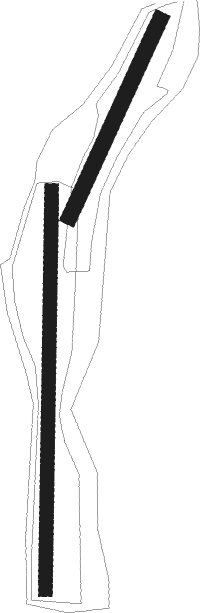
Runway info
Runway 02 / 20  | ||
| length | 452m (1483ft) | |
| bearing | 41° / 221° | |
| width | 32m (106ft) | |
| surface | grass | |
| Runway 01 / 19 | ||
| length | 831m (2726ft) | |
| bearing | 8° / 188° | |
| width | 28m (93ft) | |
| surface | grass | |
Nearby beacons
| code | identifier | dist | bearing | frequency |
|---|---|---|---|---|
| BAY | BAYREUTH VOR | 25.2 | 165° | 110.60 |
| ERF | ERFURT VOR/DME | 34.8 | 333° | 113.85 |
| OKG | CHEB VOR/DME | 39.4 | 111° | 115.70 |
| EFD | DME | 41.1 | 316° | 112.05 |
| GRW | GRAFENWOHR NDB | 45.2 | 149° | 405 |
| GRF | GRAFENWOHR TACAN | 45.4 | 150° | 111.80 |
| ERL | ERLANGEN VOR/DME | 46.9 | 207° | 114.90 |
| AGD | DME | 51.4 | 59° | 115.30 |
| ABU | ALTENBURG NDB | 52.1 | 59° | 330 |
| RTB | ROETHENBACH NDB | 56 | 196° | 415 |
| NGD | DME | 56.5 | 206° | 113.10 |
| GOT | GOTEM VOR/DME | 56.7 | 5° | 115.25 |
| NUB | NUERNBERG VOR/DME | 57 | 209° | 115.75 |
Disclaimer
The information on this website is not for real aviation. Use this data with the X-Plane flight simulator only! Data taken with kind consent from X-Plane 12 source code and data files. Content is subject to change without notice.