Welzheim - Welzheim Glider Field
Airport details
| Country | Germany |
| State | Baden-Württemberg |
| Region | |
| Airspace | Langen Ctr |
| Municipality | Welzheim |
| Elevation | 1699ft (518m) |
| Timezone | GMT +1 |
| Coordinates | 48.87627, 9.65357 |
| Magnetic var | |
| Type | land |
| Available since | X-Plane v10.40 |
| ICAO code | XEDGC |
| IATA code | n/a |
| FAA code | n/a |
Communication
| Welzheim Glider Field Welzheim Info | 123.985 |
Nearby Points of Interest:
Oberes Schloss
-Villa Franck
-Villa Arnold, Schorndorf
-Rehnenhofkapelle
-Burgschloss Schorndorf
-Palmsche Apotheke
-Castra of Murrhardt
-Kloster Murrhardt
-Kirche Lindach
-Spital zum hl. Geist Schwäbisch Gmünd
-Alte PH
-Stadtarchiv Schwäbisch Gmünd
-Grät Schwäbisch Gmünd
-Kapitelshaus Schwäbisch Gmünd
-Rathaus Schwäbisch Gmünd
-Rechbergsche Scheuer
-Haltepunkt Schwäbisch Gmünd Süd
-Wallfahrtskirche Birenbach
-Altes Schloss Rechberghausen
-Neues Schloss Rechberghausen
-Jagdschloss Engelberg
-St. Nemesius
-Schloss Backnang
-Backnanger Stadthaus
-Schloss Winnental
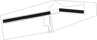
Runway info
Runway 10 / 28  | ||
| length | 252m (827ft) | |
| bearing | 96° / 276° | |
| width | 35m (115ft) | |
| surface | grass | |
| Runway 08 / 26 | ||
| length | 531m (1742ft) | |
| bearing | 86° / 266° | |
| width | 33m (107ft) | |
| surface | grass | |
Nearby beacons
| code | identifier | dist | bearing | frequency |
|---|---|---|---|---|
| LBU | LUBURG VOR/DME | 12.5 | 277° | 109.20 |
| SHD | HALL DME | 15.2 | 27° | 108.05 |
| STG | STUTTGART VOR/DME | 19 | 246° | 116.85 |
| SGD | DME | 20.4 | 246° | 115.45 |
| TGO | TANGO TACAN | 21.9 | 237° | 112.50 |
| DKB | DINKELSBUEHL VORTAC | 28 | 65° | 117.80 |
| NDD | DME-ILS | 33.3 | 31° | 108.70 |
| NSN | NIEDERSTETTEN NDB | 33.4 | 31° | 311 |
| LUP | LAUPHEIM NDB | 40.8 | 159° | 407 |
| NKR | NECKAR NDB | 45.5 | 297° | 292 |
| ILM | ILLESHEIM NDB | 45.9 | 51° | 488 |
| ANS | ANSBACH NDB | 46.4 | 66° | 452 |
| ALD | (MEMMINGEN/ALLGAU) DME | 58 | 147° | 117.20 |
| ALG | ALLGAEU (MEMMINGEN) NDB | 58 | 145° | 341 |
Disclaimer
The information on this website is not for real aviation. Use this data with the X-Plane flight simulator only! Data taken with kind consent from X-Plane 12 source code and data files. Content is subject to change without notice.