Moringen - An Der Weper
Airport details
| Country | Germany |
| State | Lower Saxony |
| Region | |
| Airspace | Bremen Ctr |
| Municipality | Moringen |
| Elevation | 1165ft (355m) |
| Timezone | GMT +1 |
| Coordinates | 51.71241, 9.80274 |
| Magnetic var | |
| Type | land |
| Available since | X-Plane v11.55 |
| ICAO code | XEDGE |
| IATA code | n/a |
| FAA code | n/a |
Communication
| An der Weper Weper Segelflug | 123.500 |
Nearby Points of Interest:
St. Nicolaikapelle
-St. Laurentiuskirche
-Burg Moringen
-St. Georgkirche
-St. Trinitatiskirche
-Alte Synagoge
-Clarissenkloster (Einbeck)
-Kornhaus
-Tiedexer Straße
-Jewish cemetery, Dassel
-Einbeck Municipal Museum
-Jewish Cemetery, Sievershausen
-Schloss Hardenberg
-Jewish cemetery, Nörten
-St. Georgskapelle
-St. Vituskirche
-Alte Burg
-Saint Martin Church
-St. Margarethen
-St. Martinskirche (Greene, Lower Saxony)
-Hünenburg bei Dransfeld
-St. Petri
-Saline Luisenhall
-Lokhalle Göttingen
-Grätzelhaus
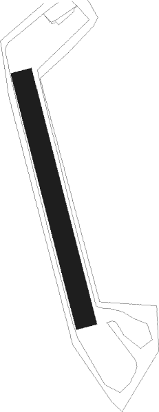
Runway info
| Runway 17 / 35 | ||
| length | 380m (1247ft) | |
| bearing | 164° / 344° | |
| width | 33m (108ft) | |
| surface | grass | |
Nearby beacons
| code | identifier | dist | bearing | frequency |
|---|---|---|---|---|
| DKS | DME-ILS | 22.9 | 234° | 111.50 |
| WRB | WARBURG VOR/DME | 28.6 | 253° | 113.70 |
| DLE | LEINE VOR/DME | 32.4 | 9° | 115.20 |
| SAS | SARSTEDT VOR/DME | 32.4 | 9° | 114.45 |
| FTZ | FRITZLAR NDB | 40.4 | 212° | 468 |
| BYC | BUECKEBURG NDB | 43.5 | 309° | 368 |
| HBD | DME | 44.9 | 349° | 116.90 |
| HA | HANNOVER NDB | 45.1 | 0° | 320 |
| HAD | DME | 45.5 | 352° | 113.95 |
| HW | HANNOVER NDB | 46.3 | 341° | 358 |
| WUN | WUNSTORF TACAN | 46.6 | 333° | 114.85 |
| BRU | BRAUNSCHWEIG-WOLFSBURG NDB | 47.1 | 53° | 427 |
| CEL | CELLE NDB | 53.3 | 14° | 311 |
| HLZ | HEHLINGEN VOR/DME | 53.5 | 57° | 117.30 |
| NIE | NIENBURG VOR | 57.1 | 335° | 116.50 |
Disclaimer
The information on this website is not for real aviation. Use this data with the X-Plane flight simulator only! Data taken with kind consent from X-Plane 12 source code and data files. Content is subject to change without notice.