Zierenberg - Zierenberg Doernberg
Airport details
| Country | Germany |
| State | Hesse |
| Region | |
| Airspace | Bremen Ctr |
| Municipality | Zierenberg |
| Elevation | 1411ft (430m) |
| Timezone | GMT +1 |
| Coordinates | 51.36985, 9.33495 |
| Magnetic var | |
| Type | land |
| Available since | X-Plane v10.40 |
| ICAO code | XEDGN |
| IATA code | n/a |
| FAA code | n/a |
Communication
| Zierenberg Doernberg Zierenberg Info | 122.300 |
Nearby Points of Interest:
Evangelische Kirche Meimbressen
-Galeriegrab Calden I
-Elfbuchenturm
-Stadthalle Kassel
-Dörnbergstraße 2 (Kassel)
-Wilhelmshöher Allee 118
-Gräfestraße 16
-Ständehaus Kassel
-Henschelhaus
-Palais Reichenbach
-Frühstückspavillon
-Ev. Garnisonskirche
-Zwehrenturm
-Elisabethhospital (Kassel)
-Haus Marställer Platz 7
-Karlshospital
-Wallburg Großenritte
-Bahnhof Baunatal-Großenritte
-Bahnhof Liebenau
-Steinernes Haus (Hofgeismar)
-Petriplatz 2 (Hofgeismar)
-Evangelische Kirche Carlsdorf
-St. Johannis Holzhausen
-Evangelische Kirche Kirchbauna
-Eulenturm
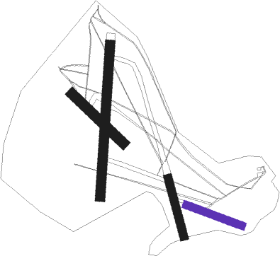
Runway info
| Runway 11 / 29 | ||
| length | 282m (925ft) | |
| bearing | 106° / 286° | |
| width | 38m (124ft) | |
| surface | grass | |
Runway 17 / 35  | ||
| length | 286m (938ft) | |
| bearing | 163° / 343° | |
| width | 38m (126ft) | |
| surface | grass | |
| Runway 01 / 19 | ||
| length | 729m (2392ft) | |
| bearing | 13° / 193° | |
| width | 46m (150ft) | |
| surface | grass | |
| Runway 13 / 31 | ||
| length | 338m (1109ft) | |
| bearing | 125° / 305° | |
| width | 50m (164ft) | |
| surface | grass | |
Nearby beacons
| code | identifier | dist | bearing | frequency |
|---|---|---|---|---|
| DKS | DME-ILS | 4 | 54° | 111.50 |
| WRB | WARBURG VOR/DME | 11.7 | 301° | 113.70 |
| FTZ | FRITZLAR NDB | 17.4 | 164° | 468 |
| PAD | PADERBORN-LIPPSTADT NDB | 30.1 | 290° | 354 |
| PAD | DME-ILS | 30.4 | 289° | 108.50 |
| FUL | FULDA VOR/DME | 47.5 | 163° | 112.10 |
| BYC | BUECKEBURG NDB | 56 | 345° | 368 |
| DLE | LEINE VOR/DME | 56.6 | 32° | 115.20 |
| SAS | SARSTEDT VOR/DME | 56.7 | 32° | 114.45 |
| GED | GEDERN VORTAC | 57.6 | 185° | 110.80 |
Disclaimer
The information on this website is not for real aviation. Use this data with the X-Plane flight simulator only! Data taken with kind consent from X-Plane 12 source code and data files. Content is subject to change without notice.