Rastatt - Rastatt-baldenau
Airport details
| Country | Germany |
| State | Baden-Württemberg |
| Region | |
| Airspace | Langen Ctr |
| Municipality | Rastatt |
| Elevation | 378ft (115m) |
| Timezone | GMT +1 |
| Coordinates | 48.87161, 8.20766 |
| Magnetic var | |
| Type | land |
| Available since | X-Plane v10.40 |
| ICAO code | XEDRB |
| IATA code | n/a |
| FAA code | n/a |
Communication
| Rastatt-Baldenau Rastatt Info | 132.640 |
Nearby Points of Interest:
Upper Rhine
-Town hall of Lauterbourg
-Alter Bahnhof
-Jewish cemetery of Niederroedern
-Baden-Baden
-banc-reposoir de Rœschwoog
-Amtsgericht Gernsbach
-Jakobskirche Gernsbach
-St. Martin
-Herrenalb Abbey
-Karlsruhe Observatory
-Verwaltungsgebäude der LVA Baden
-Rathaus West
-Verwaltungsgericht Karlsruhe
-Erbgroßherzogliches Palais
-Baischstraße
-Landratsamt Karlsruhe
-Leibgrenadierdenkmal
-Markgräfliches Palais
-Rathaus Karlsruhe
-Schwedenpalais
-Landgericht Karlsruhe
-Schlossplatz
-Bühlerhöhe
Runway info
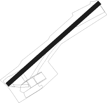
| Runway 05 / 23 | ||
| length | 998m (3274ft) | |
| bearing | 63° / 243° | |
| width | 37m (123ft) | |
| surface | grass | |
Nearby beacons
| code | identifier | dist | bearing | frequency |
|---|---|---|---|---|
| KBA | KARLSRUHE/BADEN-BADEN NDB | 6.2 | 236° | 431 |
| KBD | DME | 7.2 | 233° | 115.80 |
| KRH | KARLSRUHE VOR/DME | 16.5 | 72° | 115.95 |
| SE | STRASBOURG NDB | 25.8 | 240° | 412 |
| SAV | SAVERNE VOR/DME | 30.3 | 264° | 110.45 |
| STR | STRASBOURG ENTZHEIM VOR/DME | 33.4 | 240° | 115.60 |
| LRD | DME | 34 | 217° | 108.05 |
| SUL | SULZ VOR | 34.1 | 138° | 116.10 |
| NKR | NECKAR NDB | 34.7 | 48° | 292 |
| LHR | LAHR NDB | 35.1 | 217° | 337 |
| ZWN | ZWEIBRUECKEN VOR/DME | 37.7 | 294° | 114.80 |
| MND | DME | 37.9 | 27° | 113.55 |
| RMS | RAMSTEIN TACAN | 41.7 | 312° | 113.40 |
| SR | ENSHEIM (SAARBRUECKEN) NDB | 44.1 | 289° | 360 |
| HO | COLMAR-HOUSSEN NDB | 55.5 | 229° | 380 |
| RID | RIED VOR/DME | 56.1 | 20° | 112.20 |
Disclaimer
The information on this website is not for real aviation. Use this data with the X-Plane flight simulator only! Data taken with kind consent from X-Plane 12 source code and data files. Content is subject to change without notice.