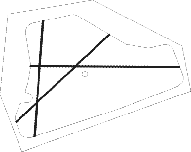
Weston On The Green
Airport details
| Country | United Kingdom |
| State | England |
| Region | |
| Airspace | London Ctr |
| Municipality | Cherwell District |
| Elevation | 282ft (86m) |
| Timezone | GMT +0 |
| Coordinates | 51.87724, -1.22711 |
| Magnetic var | |
| Type | land |
| Available since | X-Plane v10.40 |
| ICAO code | XEG0002 |
| IATA code | n/a |
| FAA code | n/a |
Communication
Nearby Points of Interest:
Middleton Park, Oxfordshire
-Rousham House
-Kidlington railway station
-Beckley Park
-Studley Priory, Oxfordshire
-Woodperry House
-The Bell Inn, Long Hanborough
-Kiddington Hall
-66, Banbury Road
-Belsyre Court
-Radcliffe Observatory
-Radcliffe Infirmary
-Lamb & Flag
-Holywell Manor, Oxford
-Pusey House, Oxford
-Upplands runinskrifter 104
-Weston Library
-Indian Institute
-Codrington Library
-Rewley Road Swing Bridge
-Radcliffe Quadrangle
-Buildings of Nuffield College, Oxford
-Florey Building
-Oxford Town Hall
-Peckwater Quadrangle

Nearby beacons
| code | identifier | dist | bearing | frequency |
|---|---|---|---|---|
| OX | OXFORD NDB | 4.4 | 246° | 367 |
| WCO | WESTCOTT NDB | 9.9 | 95° | 335 |
| BZ | BRIZE NORTON NDB | 15.8 | 251° | 386 |
| BZN | BRIZE NORTON TACAN | 15.9 | 251° | 111.90 |
| BSO | BENSON TACAN | 16.4 | 154° | 110 |
| HEN | HENTON NDB | 17.6 | 105° | 433 |
| DTY | DAVENTRY VOR/DME | 18.6 | 21° | 116.40 |
| CPT | COMPTON VOR/DME | 23.1 | 179° | 114.35 |
| FFA | FAIRFORD TACAN | 24.2 | 251° | 113.40 |
| BNN | BOVINGDON VOR/DME | 26.7 | 103° | 113.75 |
| WOD | WOODLEY NDB | 28.6 | 141° | 352 |
| CIT | CRANFIELD NDB | 29 | 69° | 850 |
| BUR | BURNHAM NDB | 29.6 | 123° | 421 |
| CHT | CHILTERN NDB | 30.4 | 110° | 277 |
| HON | HONILEY VOR/DME | 32.9 | 318° | 113.65 |
| GST | GLOUCESTERSHIRE NDB | 34.8 | 271° | 331 |
| BLC | DME | 36.1 | 145° | 116.20 |
| BLK | BLACKBUSHE NDB | 36.1 | 145° | 328 |
| LUT | LUTON NDB | 36.1 | 89° | 345 |
| LON | LONDON VOR/DME | 36.7 | 117° | 113.60 |
| BHX | BIRMINGHAM NDB | 39.7 | 318° | 406 |
| ODH | ODIHAM TACAN | 40 | 157° | 109.60 |
| LE | LEICESTER NDB | 44.3 | 15° | 383 |
| OCK | OCKHAM VOR/DME | 45 | 126° | 115.30 |
| EPM | EPSOM NDB | 46.2 | 123° | 316 |
| BDN | BOSCOMBE DOWN TACAN | 47.9 | 216° | 108.20 |
| WIT | WITTERING TACAN | 51.4 | 45° | 117.60 |
| MID | MIDHURST VOR/DME | 54.3 | 144° | 114 |
| EAS | SOUTHAMPTON (EASTLEIGH) NDB | 55.5 | 188° | 391 |
| SAM | SOUTHAMPTON VOR/DME | 55.5 | 187° | 113.35 |
| EME | EAST MIDLANDS NDB | 57.3 | 2° | 353 |
| EMW | EAST MIDLANDS NDB | 57.7 | 347° | 393 |
| TNL | TATENHILL NDB | 59.6 | 330° | 327 |
| MLD | MILDENHALL TACAN | 69.6 | 74° | 115.90 |
| LKH | LAKENHEATH TACAN | 72.7 | 73° | 110.20 |
| SND | SOUTHEND NDB | 73.9 | 99° | 362 |
Disclaimer
The information on this website is not for real aviation. Use this data with the X-Plane flight simulator only! Data taken with kind consent from X-Plane 12 source code and data files. Content is subject to change without notice.