Lower Brailes - Shenington
Airport details
| Country | United Kingdom |
| State | England |
| Region | |
| Airspace | London Ctr |
| Municipality | Cherwell District |
| Elevation | 642ft (196m) |
| Timezone | GMT +0 |
| Coordinates | 52.08872, -1.47836 |
| Magnetic var | |
| Type | land |
| Available since | X-Plane v10.40 |
| ICAO code | XEG0004 |
| IATA code | n/a |
| FAA code | n/a |
Communication
Nearby Points of Interest:
Compton Wynyates
-Battle of Edgehil
-Wroxton Abbey
-Broadclose
-Honington Hall
-Whichford House
-Town Hall Town Hall And Attached Walls
-Bath House, Warwickshire
-Battle of Cropredy Bridge
-Chacombe Priory
-Moreton Hall
-Wellesbourne Watermill
-Wormleighton Manor
-Wardington Manor
-Edgcote House
-Ashorne Hill Management College
-Charlecote Park
-Thenford House
-Alscot Park
-Bridge Over River Avon
-Chipping Norton Recording Studios
-Bliss Tweed Mill
-Ebrington Manor
-The Cottage
-Clopton Bridge
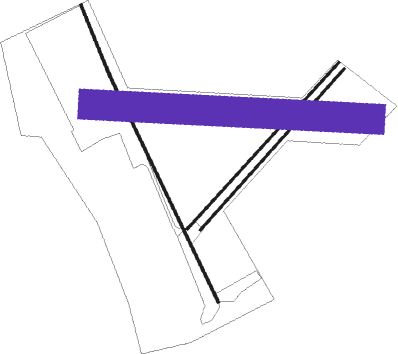
Runway info
Runway 16L / 34R  | ||
| length | 226m (741ft) | |
| bearing | 153° / 333° | |
| width | 7m (23ft) | |
| surface | asphalt | |
| Runway 16R / 34L | ||
| length | 761m (2497ft) | |
| bearing | 148° / 328° | |
| width | 7m (23ft) | |
| surface | asphalt | |
| Runway 05L / 23R | ||
| length | 678m (2224ft) | |
| bearing | 60° / 240° | |
| width | 7m (23ft) | |
| surface | asphalt | |
| Runway 05R / 23L | ||
| length | 650m (2133ft) | |
| bearing | 60° / 240° | |
| width | 7m (23ft) | |
| surface | asphalt | |
| Runway 10 / 28 | ||
| length | 837m (2746ft) | |
| bearing | 95° / 275° | |
| width | 90m (295ft) | |
| surface | hard surface | |
Nearby beacons
| code | identifier | dist | bearing | frequency |
|---|---|---|---|---|
| DTY | DAVENTRY VOR/DME | 14.5 | 76° | 116.40 |
| OX | OXFORD NDB | 16.3 | 149° | 367 |
| HON | HONILEY VOR/DME | 17.4 | 325° | 113.65 |
| BZ | BRIZE NORTON NDB | 20.8 | 200° | 386 |
| BZN | BRIZE NORTON TACAN | 20.9 | 200° | 111.90 |
| WCO | WESTCOTT NDB | 23.7 | 115° | 335 |
| BHX | BIRMINGHAM NDB | 24.1 | 323° | 406 |
| FFA | FAIRFORD TACAN | 27.1 | 218° | 113.40 |
| GST | GLOUCESTERSHIRE NDB | 28.1 | 254° | 331 |
| BSO | BENSON TACAN | 31.7 | 141° | 110 |
| HEN | HENTON NDB | 32.2 | 116° | 433 |
| CIT | CRANFIELD NDB | 34 | 87° | 850 |
| LE | LEICESTER NDB | 35 | 41° | 383 |
| CPT | COMPTON VOR/DME | 37.1 | 157° | 114.35 |
| WBA | WOLVERHAMPTON NDB | 38.5 | 299° | 356 |
| WOL | DME | 38.5 | 299° | 108.60 |
| BNN | BOVINGDON VOR/DME | 40.7 | 111° | 113.75 |
| WOD | WOODLEY NDB | 44.2 | 137° | 352 |
| EMW | EAST MIDLANDS NDB | 44.4 | 2° | 393 |
| TNL | TATENHILL NDB | 44.8 | 338° | 327 |
| CHT | CHILTERN NDB | 45.2 | 116° | 277 |
| BUR | BURNHAM NDB | 45.3 | 125° | 421 |
| EME | EAST MIDLANDS NDB | 45.8 | 21° | 353 |
| WIT | WITTERING TACAN | 47.5 | 62° | 117.60 |
| BLC | DME | 51.6 | 140° | 116.20 |
| BLK | BLACKBUSHE NDB | 51.6 | 140° | 328 |
| ODH | ODIHAM TACAN | 55 | 148° | 109.60 |
| BDN | BOSCOMBE DOWN TACAN | 57.3 | 196° | 108.20 |
| TNT | TRENT VOR/DME | 58.3 | 349° | 115.70 |
| CWL | CRANWELL NDB | 66.8 | 47° | 423 |
| CWZ | CRANWELL TACAN | 67 | 47° | 117.40 |
| MLD | MILDENHALL TACAN | 74.2 | 82° | 115.90 |
Disclaimer
The information on this website is not for real aviation. Use this data with the X-Plane flight simulator only! Data taken with kind consent from X-Plane 12 source code and data files. Content is subject to change without notice.