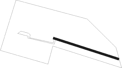
Stonesfield - Oaklands
Airport details
| Country | United Kingdom |
| State | England |
| Region | |
| Airspace | London Ctr |
| Municipality | West Oxfordshire |
| Elevation | 379ft (116m) |
| Timezone | GMT +0 |
| Coordinates | 51.84789, -1.44241 |
| Magnetic var | |
| Type | land |
| Available since | X-Plane v10.40 |
| ICAO code | XEG0005 |
| IATA code | n/a |
| FAA code | n/a |
Communication
Nearby Points of Interest:
Eynsham Hall
-The Bell Inn, Long Hanborough
-The Henry Box School
-Kiddington Hall
-Town Hall
-Ascot d'Oilly Castle
-Swinford Toll Bridge
-Kidlington railway station
-Asthall Manor
-Rousham House
-Bruern Abbey
-Chipping Norton Recording Studios
-Bliss Tweed Mill
-Burford Priory
-Middleton Park, Oxfordshire
-Newbridge
-Belsyre Court
-66, Banbury Road
-Bampton Castle, Oxfordshire
-Radcliffe Observatory
-Rewley Road Swing Bridge
-Radcliffe Infirmary
-Osney Abbey
-Lamb & Flag
-Pusey House, Oxford
Nearby beacons
| code | identifier | dist | bearing | frequency |
|---|---|---|---|---|
| OX | OXFORD NDB | 4.4 | 97° | 367 |
| BZ | BRIZE NORTON NDB | 8.3 | 238° | 386 |
| BZN | BRIZE NORTON TACAN | 8.4 | 238° | 111.90 |
| FFA | FAIRFORD TACAN | 16.5 | 245° | 113.40 |
| WCO | WESTCOTT NDB | 17.8 | 89° | 335 |
| BSO | BENSON TACAN | 18.9 | 124° | 110 |
| CPT | COMPTON VOR/DME | 22.9 | 148° | 114.35 |
| DTY | DAVENTRY VOR/DME | 23.3 | 45° | 116.40 |
| HEN | HENTON NDB | 24.7 | 98° | 433 |
| GST | GLOUCESTERSHIRE NDB | 27 | 273° | 331 |
| HON | HONILEY VOR/DME | 31.6 | 336° | 113.65 |
| WOD | WOODLEY NDB | 31.6 | 125° | 352 |
| BNN | BOVINGDON VOR/DME | 33.9 | 98° | 113.75 |
| BUR | BURNHAM NDB | 34.6 | 113° | 421 |
| CIT | CRANFIELD NDB | 36.8 | 72° | 850 |
| CHT | CHILTERN NDB | 36.9 | 104° | 277 |
| BHX | BIRMINGHAM NDB | 38.1 | 333° | 406 |
| BLC | DME | 38.5 | 131° | 116.20 |
| BLK | BLACKBUSHE NDB | 38.5 | 131° | 328 |
| ODH | ODIHAM TACAN | 41.2 | 141° | 109.60 |
| LON | LONDON VOR/DME | 42.3 | 110° | 113.60 |
| BDN | BOSCOMBE DOWN TACAN | 43.5 | 204° | 108.20 |
| LE | LEICESTER NDB | 47.9 | 28° | 383 |
| OCK | OCKHAM VOR/DME | 49.4 | 119° | 115.30 |
| WBA | WOLVERHAMPTON NDB | 50.1 | 309° | 356 |
| WOL | DME | 50.1 | 309° | 108.60 |
| EAS | SOUTHAMPTON (EASTLEIGH) NDB | 53.7 | 174° | 391 |
| SAM | SOUTHAMPTON VOR/DME | 53.7 | 174° | 113.35 |
| MID | MIDHURST VOR/DME | 56.6 | 134° | 114 |
| WIT | WITTERING TACAN | 57.3 | 51° | 117.60 |
| EMW | EAST MIDLANDS NDB | 58.9 | 359° | 393 |
| TNL | TATENHILL NDB | 59.2 | 341° | 327 |
| EME | EAST MIDLANDS NDB | 59.8 | 14° | 353 |
| GWC | GOODWOOD VOR/DME | 64.9 | 145° | 114.75 |
Disclaimer
The information on this website is not for real aviation. Use this data with the X-Plane flight simulator only! Data taken with kind consent from X-Plane 12 source code and data files. Content is subject to change without notice.