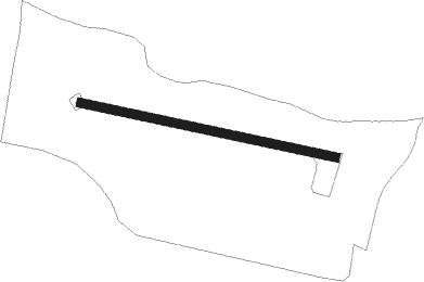
Pangbourne - Whittles
Airport details
| Country | United Kingdom |
| State | England |
| Region | |
| Airspace | London Ctr |
| Municipality | South Oxfordshire |
| Elevation | 347ft (106m) |
| Timezone | GMT +0 |
| Coordinates | 51.50156, -1.04073 |
| Magnetic var | |
| Type | land |
| Available since | X-Plane v10.40 |
| ICAO code | XEG000A |
| IATA code | n/a |
| FAA code | n/a |
Communication
Nearby Points of Interest:
Hardwick House
-Whitchurch Bridge
-Kidmore House
-Chazey Court Barn
-West Memorial Hall
-Bath Road Reservoir
-Broad Street Independent Chapel, Reading
-Reading Town Hall
-Vachel Almshouses
-Abbey Mill
-Sacred Heart Church, Reading
-Albion Terrace, Reading
-Garston Lock
-University of Reading War Memorial
-Sheffield Lock
-Sonning Bridge
-Foxhill House
-Deanery Garden
-Friar Park
-Town Hall
-Folly Farmhouse And Entrance Court To East
-Carmel College
-Fawley Court
-Park Place
-Hannen Columbarium
Nearby beacons
| code | identifier | dist | bearing | frequency |
|---|---|---|---|---|
| CPT | COMPTON VOR/DME | 6.7 | 267° | 114.35 |
| WOD | WOODLEY NDB | 6.7 | 107° | 352 |
| BSO | BENSON TACAN | 7.1 | 333° | 110 |
| BLC | DME | 12.9 | 132° | 116.20 |
| BLK | BLACKBUSHE NDB | 12.9 | 132° | 328 |
| BUR | BURNHAM NDB | 13.6 | 87° | 421 |
| ODH | ODIHAM TACAN | 16.5 | 161° | 109.60 |
| HEN | HENTON NDB | 18 | 44° | 433 |
| CHT | CHILTERN NDB | 20.8 | 77° | 277 |
| WCO | WESTCOTT NDB | 21.3 | 13° | 335 |
| LON | LONDON VOR/DME | 21.4 | 91° | 113.60 |
| OX | OXFORD NDB | 22.5 | 320° | 367 |
| BNN | BOVINGDON VOR/DME | 22.7 | 65° | 113.75 |
| OCK | OCKHAM VOR/DME | 25.1 | 108° | 115.30 |
| BZ | BRIZE NORTON NDB | 25.6 | 294° | 386 |
| BZN | BRIZE NORTON TACAN | 25.6 | 294° | 111.90 |
| EPM | EPSOM NDB | 27.3 | 105° | 316 |
| FFA | FAIRFORD TACAN | 30.2 | 283° | 113.40 |
| MID | MIDHURST VOR/DME | 31 | 137° | 114 |
| BDN | BOSCOMBE DOWN TACAN | 34 | 244° | 108.20 |
| SAM | SOUTHAMPTON VOR/DME | 34.7 | 209° | 113.35 |
| EAS | SOUTHAMPTON (EASTLEIGH) NDB | 34.9 | 210° | 391 |
| LUT | LUTON NDB | 37.6 | 63° | 345 |
| BPK | BROOKMANS PARK VOR/DME | 37.8 | 75° | 117.50 |
| GWC | GOODWOOD VOR/DME | 40.2 | 156° | 114.75 |
| DTY | DAVENTRY VOR/DME | 40.8 | 354° | 116.40 |
| LCY | LONDON CITY NDB | 41.4 | 90° | 322 |
| CIT | CRANFIELD NDB | 41.8 | 38° | 850 |
| LAM | LAMBOURNE VOR/DME | 45.3 | 83° | 115.60 |
| SHM | SHOREHAM NDB | 48.8 | 132° | 332 |
| SRH | DME-ILS | 48.8 | 132° | 109.95 |
| BKY | BARKWAY VOR/DME | 50.4 | 66° | 116.25 |
| MAY | MAYFIELD VOR/DME | 52.3 | 113° | 117.90 |
| BIA | BOURNEMOUTH NDB | 52.9 | 228° | 339 |
| HON | HONILEY VOR/DME | 56.3 | 324° | 113.65 |
| CAM | CAMBRIDGE NDB | 62.2 | 60° | 332 |
| SFD | SEAFORD VOR/DME | 62.4 | 123° | 117 |
| DET | DETLING VOR/DME | 62.5 | 97° | 117.30 |
| BHX | BIRMINGHAM NDB | 62.9 | 323° | 406 |
| SND | SOUTHEND NDB | 65.1 | 88° | 362 |
| HLS | DME | 66.8 | 102° | 115.95 |
| LSH | HEADCORN (LASHENDEN) NDB | 66.8 | 102° | 340 |
Disclaimer
The information on this website is not for real aviation. Use this data with the X-Plane flight simulator only! Data taken with kind consent from X-Plane 12 source code and data files. Content is subject to change without notice.