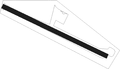
Dickens Heath - Woods Farm
Airport details
| Country | United Kingdom |
| State | England |
| Region | |
| Airspace | London Ctr |
| Municipality | Metropolitan Borough of Solihull |
| Elevation | 469ft (143m) |
| Timezone | GMT +0 |
| Coordinates | 52.39466, -1.84319 |
| Magnetic var | |
| Type | land |
| Available since | X-Plane v10.40 |
| ICAO code | XEG001H |
| IATA code | n/a |
| FAA code | n/a |
Communication
Nearby Points of Interest:
St Mary's Church, Wythall
-King's Norton Stop Lock
-Saracen's Head
-Moseley Hall, Birmingham
-Umberslade Hall
-Obelisk At Umberslade Park
-Hay Hall
-Emmanuel Church
-Minworth Greaves
-Moseley School of Art, Balsall Heath
-Church of St Oswald
-Friends' Institute buildings
-Selly Oak Library
-Selly Oak Pumping Station
-Stratford House
-Edgbaston Hall
-St James'
-St James’s House
-Singers Hill Synagogue
-Fox And Grapes
-Holliday Street Aqueduct
-Curzon Street railway station
-Christopher Wray Lighting works
-Queen's College
-Alpha Tower
Nearby beacons
| code | identifier | dist | bearing | frequency |
|---|---|---|---|---|
| BHX | BIRMINGHAM NDB | 4.8 | 57° | 406 |
| HON | HONILEY VOR/DME | 6.9 | 102° | 113.65 |
| WBA | WOLVERHAMPTON NDB | 16.9 | 286° | 356 |
| WOL | DME | 16.9 | 286° | 108.60 |
| TNL | TATENHILL NDB | 25.3 | 10° | 327 |
| EMW | EAST MIDLANDS NDB | 29.6 | 42° | 393 |
| DTY | DAVENTRY VOR/DME | 29.7 | 106° | 116.40 |
| LE | LEICESTER NDB | 32.1 | 75° | 383 |
| GST | GLOUCESTERSHIRE NDB | 32.4 | 213° | 331 |
| EME | EAST MIDLANDS NDB | 35.3 | 56° | 353 |
| SWB | SHAWBURY VOR/DME | 38.4 | 296° | 116.80 |
| OX | OXFORD NDB | 38.7 | 137° | 367 |
| BZ | BRIZE NORTON NDB | 39.7 | 159° | 386 |
| BZN | BRIZE NORTON TACAN | 39.8 | 160° | 111.90 |
| TNT | TRENT VOR/DME | 40 | 15° | 115.70 |
| FFA | FAIRFORD TACAN | 42.8 | 176° | 113.40 |
| WCO | WESTCOTT NDB | 45.9 | 122° | 335 |
| BSO | BENSON TACAN | 54.3 | 136° | 110 |
| WHI | WHITEGATE NDB | 55.2 | 315° | 368 |
| CPT | COMPTON VOR/DME | 58.9 | 145° | 114.35 |
| OF | FILTON NDB | 59.3 | 221° | 325 |
| MCT | MANCHESTER VOR/DME | 59.7 | 336° | 113.55 |
| GAM | GAMSTON VOR/DME | 62.3 | 45° | 112.80 |
| LPL | LIVERPOOL NDB | 65.1 | 317° | 349 |
| WOD | WOODLEY NDB | 66.8 | 134° | 352 |
Disclaimer
The information on this website is not for real aviation. Use this data with the X-Plane flight simulator only! Data taken with kind consent from X-Plane 12 source code and data files. Content is subject to change without notice.