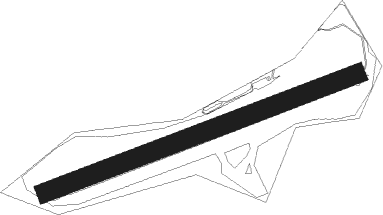
Uley - Nympsfield
Airport details
| Country | United Kingdom |
| State | England |
| Region | |
| Airspace | London Ctr |
| Municipality | Stroud |
| Elevation | 714ft (218m) |
| Timezone | GMT +0 |
| Coordinates | 51.71260, -2.29228 |
| Magnetic var | |
| Type | land |
| Available since | X-Plane v10.40 |
| ICAO code | XEG002L |
| IATA code | n/a |
| FAA code | n/a |
Communication
Nearby Points of Interest:
Coaley Wood Quarries
-Owlpen Manor
-The Gatehouse at Bonds Mill
-Stouts Hill
-Woodchester Roman Villa
-Congregational Chapel
-Egypt Mill
-Kingscote and Horsley Woods
-Rodborough Common
-Minchinhampton Common
-Kingscote Park
-Town Hall
-Box Farm Meadows SSSI
-Frampton Pools
-Nether Lypiatt Manor
-Frampton Court
-Coombe Hill, Stroud
-Lasborough Park
-St Mary of the Angels Church, Brownshill
-Boxwell SSSI
-Boxwell Court
-Edge Common
-Bull Cross, The Frith and Juniper Hill
-Beacon House
-Wick Court
Nearby beacons
| code | identifier | dist | bearing | frequency |
|---|---|---|---|---|
| GST | GLOUCESTERSHIRE NDB | 11.7 | 35° | 331 |
| OF | FILTON NDB | 16 | 237° | 325 |
| FFA | FAIRFORD TACAN | 18.5 | 94° | 113.40 |
| BRI | BRISTOL NDB | 25.4 | 232° | 414 |
| BZ | BRIZE NORTON NDB | 25.7 | 87° | 386 |
| BZN | BRIZE NORTON TACAN | 25.7 | 87° | 111.90 |
| BCN | BRECON VOR/DME | 36.1 | 271° | 117.45 |
| OX | OXFORD NDB | 36.7 | 83° | 367 |
| SH | SHOBDON NDB | 38.5 | 312° | 426 |
| BDN | BOSCOMBE DOWN TACAN | 39.4 | 136° | 108.20 |
| VLN | YEOVILTON TACAN | 44.4 | 206° | 111 |
| HON | HONILEY VOR/DME | 45.1 | 44° | 113.65 |
| WBA | WOLVERHAMPTON NDB | 48.2 | 2° | 356 |
| WOL | DME | 48.2 | 2° | 108.60 |
| YVL | YEOVIL NDB | 48.3 | 206° | 343 |
| BHX | BIRMINGHAM NDB | 48.8 | 36° | 406 |
| EAS | SOUTHAMPTON (EASTLEIGH) NDB | 57.4 | 129° | 391 |
| SAM | SOUTHAMPTON VOR/DME | 57.7 | 129° | 113.35 |
| BIA | BOURNEMOUTH NDB | 58.6 | 154° | 339 |
| WPL | WELSHPOOL NDB | 63.5 | 317° | 323 |
Disclaimer
The information on this website is not for real aviation. Use this data with the X-Plane flight simulator only! Data taken with kind consent from X-Plane 12 source code and data files. Content is subject to change without notice.