Pontefract - Walton Wood
Airport details
| Country | United Kingdom |
| State | England |
| Region | |
| Airspace | London Ctr |
| Municipality | Wakefield |
| Elevation | 180ft (55m) |
| Timezone | GMT +0 |
| Coordinates | 53.62751, -1.26957 |
| Magnetic var | |
| Type | land |
| Available since | X-Plane v10.40 |
| ICAO code | XEG003A |
| IATA code | n/a |
| FAA code | n/a |
Communication
| Walton Wood Walton Wood | 129.700 |
Nearby Points of Interest:
Robin Hood's Well
-Hooton Pagnell Hall
-Old Town Hall
-Pontefract Market Hall
-Burntwood Hall
-Nostell Priory
-Hodroyd Hall
-Hickleton Hall
-Walton Hall
-Nether Hall
-Mansion House, Doncaster
-Town Hall
-Monk Fryston Hall
-Woolley Hall
-Barnsley Town Hall
-Wakefield Castle
-Drury Lane Library
-County Hall, Wakefield
-Elsecar Ironworks
-Hoober Stand
-Houndhill
-Cowick Hall
-Cantley Hall
-Wadworth Hall
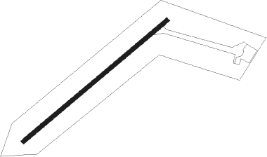
Runway info
| Runway 06 / 24 | ||
| length | 701m (2300ft) | |
| bearing | 67° / 247° | |
| width | 16m (52ft) | |
| surface | grass | |
Nearby beacons
| code | identifier | dist | bearing | frequency |
|---|---|---|---|---|
| SBL | SHERBURN-IN-ELMET NDB | 9.9 | 21° | 323 |
| FNY | DONCASTER SHEFFIELD NDB | 13.2 | 120° | 338 |
| LBA | LEEDS BRADFORD NDB | 19.7 | 302° | 402 |
| GAM | GAMSTON VOR/DME | 23.7 | 137° | 112.80 |
| POL | POLE HILL VOR/DME | 30.4 | 278° | 112.10 |
| KIM | HUMBERSIDE NDB | 32.7 | 93° | 365 |
| TNT | TRENT VOR/DME | 37.3 | 215° | 115.70 |
| WAD | WADDINGTON TACAN | 38.4 | 122° | 117.10 |
| MCT | MANCHESTER VOR/DME | 39 | 255° | 113.55 |
| LEE | LEEMING TACAN | 41.3 | 338° | 112.60 |
| CWL | CRANWELL NDB | 45.6 | 128° | 423 |
| CWZ | CRANWELL TACAN | 45.6 | 127° | 117.40 |
| EME | EAST MIDLANDS NDB | 47.8 | 175° | 353 |
| EMW | EAST MIDLANDS NDB | 48.4 | 193° | 393 |
| TNL | TATENHILL NDB | 51.9 | 211° | 327 |
| TD | TEESSIDE INTL NDB | 56 | 356° | 347 |
Disclaimer
The information on this website is not for real aviation. Use this data with the X-Plane flight simulator only! Data taken with kind consent from X-Plane 12 source code and data files. Content is subject to change without notice.