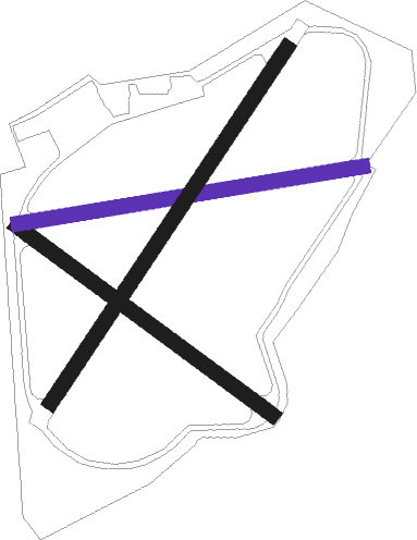
Little Rissington
Airport details
| Country | United Kingdom |
| State | England |
| Region | |
| Airspace | London Ctr |
| Municipality | Cotswold District |
| Elevation | 471ft (144m) |
| Timezone | GMT +0 |
| Coordinates | 51.86740, -1.70095 |
| Magnetic var | |
| Type | land |
| Available since | X-Plane v10.40 |
| ICAO code | XEG003O |
| IATA code | n/a |
| FAA code | n/a |
Communication
| Little Rissington Rissington Radio | 120.775 |
Nearby Points of Interest:
Icomb Place
-Salmonsbury Meadows SSSI
-Barrington Park
-Sherborne House, Gloucestershire
-Bruern Abbey
-Brassey SSSI
-Burford Priory
-Abbotswood, Gloucestershire
-Battle of Stow-on-the-Wold
-Westwell War Memorial
-Daylesford House
-Ascot d'Oilly Castle
-Huntsman's Quarry
-Asthall Manor
-Barton Bushes
-Bliss Tweed Mill
-Lark Wood
-Sezincote House
-Chipping Norton Recording Studios
-Bourton Down
-Manor Farmhouse
-Hawling Manor
-Batsford Arboretum
-Hornsleasow Quarry
-Winson Meadows
Nearby beacons
| code | identifier | dist | bearing | frequency |
|---|---|---|---|---|
| BZ | BRIZE NORTON NDB | 7.9 | 140° | 386 |
| BZN | BRIZE NORTON TACAN | 8 | 141° | 111.90 |
| FFA | FAIRFORD TACAN | 11.7 | 207° | 113.40 |
| OX | OXFORD NDB | 14.1 | 95° | 367 |
| GST | GLOUCESTERSHIRE NDB | 17.3 | 273° | 331 |
| BSO | BENSON TACAN | 27 | 113° | 110 |
| WCO | WESTCOTT NDB | 27.4 | 91° | 335 |
| DTY | DAVENTRY VOR/DME | 28.6 | 62° | 116.40 |
| CPT | COMPTON VOR/DME | 28.8 | 128° | 114.35 |
| HON | HONILEY VOR/DME | 29.4 | 4° | 113.65 |
| HEN | HENTON NDB | 34.4 | 97° | 433 |
| BHX | BIRMINGHAM NDB | 35.3 | 355° | 406 |
| OF | FILTON NDB | 39.1 | 249° | 325 |
| WOD | WOODLEY NDB | 39.4 | 117° | 352 |
| BDN | BOSCOMBE DOWN TACAN | 43.2 | 184° | 108.20 |
| WBA | WOLVERHAMPTON NDB | 44 | 319° | 356 |
| WOL | DME | 44 | 319° | 108.60 |
| BLC | DME | 45.6 | 122° | 116.20 |
| BLK | BLACKBUSHE NDB | 45.6 | 122° | 328 |
| ODH | ODIHAM TACAN | 47.3 | 130° | 109.60 |
| LE | LEICESTER NDB | 50.6 | 42° | 383 |
| EAS | SOUTHAMPTON (EASTLEIGH) NDB | 56.2 | 159° | 391 |
| SAM | SOUTHAMPTON VOR/DME | 56.3 | 159° | 113.35 |
| TNL | TATENHILL NDB | 56.9 | 356° | 327 |
| EMW | EAST MIDLANDS NDB | 58.4 | 14° | 393 |
| EME | EAST MIDLANDS NDB | 60.8 | 28° | 353 |
| VLN | YEOVILTON TACAN | 62.5 | 227° | 111 |
| SWB | SHAWBURY VOR/DME | 66 | 314° | 116.80 |
| YVL | DME | 66.1 | 226° | 109.05 |
| YVL | YEOVIL NDB | 66.3 | 226° | 343 |
Disclaimer
The information on this website is not for real aviation. Use this data with the X-Plane flight simulator only! Data taken with kind consent from X-Plane 12 source code and data files. Content is subject to change without notice.

