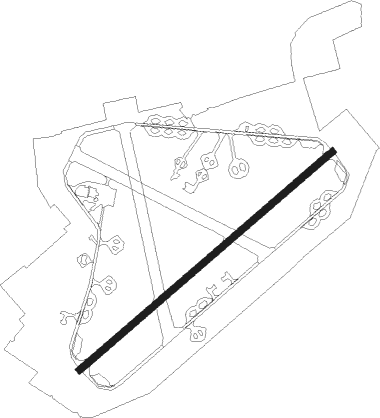
Fakenham - Raf Sculthorpe
Airport details
| Country | United Kingdom |
| State | England |
| Region | |
| Airspace | London Ctr |
| Municipality | North Norfolk |
| Elevation | 212ft (65m) |
| Timezone | GMT +0 |
| Coordinates | 52.83867, 0.74950 |
| Magnetic var | |
| Type | land |
| Available since | X-Plane v10.40 |
| ICAO code | XEG0042 |
| IATA code | n/a |
| FAA code | n/a |
Communication
Nearby Points of Interest:
Coxford Priory
-Bloodgate Hill Iron Age Fort
-Raynham Hall
-Houghton Hall
-Waterden medieval settlement remains
-Egmere medieval settlement
-Anmer Hall
-Burnham Westgate Hall
-Union Mills, Burnham Overy
-Burnham Norton Friary
-Burnham Overy Staithe Windmill
-Sennowe Hall
-Iron Age fort 900m north east of Dale Hole Cottage
-Lower Green Mill, Hindringham
-Gayton Windmill
-Gayton Hall
-West Acre Priory
-Melton Constable Hall
-Wolferton railway station
-Hunstanton Hall Moat Bridge And Garden And Forecourt Walls
-North Norfolk Coast Site of Special Scientific Interest
-Bylaugh Hall
-Bayfield Hall
-Middleton Tower
-Blakeney Windmill
Nearby beacons
| code | identifier | dist | bearing | frequency |
|---|---|---|---|---|
| MAM | MARHAM TACAN | 13.3 | 225° | 108.70 |
| NWI | NORWICH NDB | 21.9 | 107° | 342 |
| LKH | LAKENHEATH TACAN | 26.9 | 205° | 110.20 |
| MLD | MILDENHALL TACAN | 30 | 209° | 115.90 |
| CGY | CONINGSBY TACAN | 36.5 | 285° | 111.10 |
| CAM | CAMBRIDGE NDB | 43 | 222° | 332 |
| WTZ | WATTISHAM TACAN | 43.6 | 165° | 109.30 |
| CWZ | CRANWELL TACAN | 46.1 | 279° | 117.40 |
| CWL | CRANWELL NDB | 46.2 | 279° | 423 |
| WIT | WITTERING TACAN | 47.4 | 260° | 117.60 |
| WAD | WADDINGTON TACAN | 50.1 | 284° | 117.10 |
| BKY | BARKWAY VOR/DME | 56.8 | 219° | 116.25 |
| KIM | HUMBERSIDE NDB | 59.3 | 304° | 365 |
| OTR | OTTRINGHAM VOR/DME | 60 | 315° | 113.90 |
| CLN | CLACTON VOR/DME | 61.2 | 158° | 114.55 |
| CIT | CRANFIELD NDB | 63.9 | 242° | 850 |
| LE | LEICESTER NDB | 66.3 | 263° | 383 |
| GAM | GAMSTON VOR/DME | 66.7 | 285° | 112.80 |
| LUT | LUTON NDB | 67.5 | 227° | 345 |
| EME | EAST MIDLANDS NDB | 70.5 | 270° | 353 |
| FNY | DONCASTER SHEFFIELD NDB | 73.7 | 290° | 338 |
Disclaimer
The information on this website is not for real aviation. Use this data with the X-Plane flight simulator only! Data taken with kind consent from X-Plane 12 source code and data files. Content is subject to change without notice.