Bures Saint Mary - Wormingford Gliding Site
Airport details
| Country | United Kingdom |
| State | England |
| Region | EG |
| Airspace | London Ctr |
| Municipality | Colchester |
| Elevation | 235ft (72m) |
| Timezone | GMT +0 |
| Coordinates | 51.94091, 0.78120 |
| Magnetic var | |
| Type | land |
| Available since | X-Plane v10.40 |
| ICAO code | XEG004E |
| IATA code | n/a |
| FAA code | n/a |
Communication
Nearby Points of Interest:
Smallbridge Hall
-Arger Fen
-Copford Hall
-Cornard Mere
-Abbas Hall
-Town Hall
-Brooke's Nature Reserve
-Gainsborough's House
-St Michael's Church, Berechurch
-Giffords Hall
-Pitches Mount
-Belchamp Hall
-Wivenhoe House
-Groton Wood
-Gosfield Hall
-Kirby Hall
-Benton End House
-Chapel Of The Immaculate Conception, Franciscan Convent
-Braxted Park
-Tiptree Priory
-Beth Chatto Gardens
-Braintree Town Hall
-St Michael's Hospital
-Faulkbourne Hall
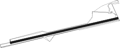
Runway info
| Runway 08 / 26 | ||
| length | 1620m (5315ft) | |
| bearing | 85° / 265° | |
| width | 30m (98ft) | |
| surface | grass | |
Nearby beacons
| code | identifier | dist | bearing | frequency |
|---|---|---|---|---|
| WTZ | WATTISHAM TACAN | 12.3 | 41° | 109.30 |
| CLN | CLACTON VOR/DME | 14.6 | 104° | 114.55 |
| SND | SOUTHEND NDB | 22.1 | 193° | 362 |
| BKY | BARKWAY VOR/DME | 26.7 | 274° | 116.25 |
| CAM | CAMBRIDGE NDB | 27.3 | 294° | 332 |
| MLD | MILDENHALL TACAN | 27.5 | 325° | 115.90 |
| LKH | LAKENHEATH TACAN | 29.2 | 333° | 110.20 |
| LAM | LAMBOURNE VOR/DME | 29.3 | 245° | 115.60 |
| BPK | BROOKMANS PARK VOR/DME | 34.8 | 258° | 117.50 |
| LCY | LONDON CITY NDB | 37.3 | 239° | 322 |
| LUT | LUTON NDB | 38.3 | 267° | 345 |
| DET | DETLING VOR/DME | 38.8 | 196° | 117.30 |
| MAM | MARHAM TACAN | 43.1 | 343° | 108.70 |
| BIG | BIGGIN VOR/DME | 46 | 231° | 115.10 |
| HLS | DME | 47.4 | 189° | 115.95 |
| LSH | HEADCORN (LASHENDEN) NDB | 47.4 | 189° | 340 |
| NWI | NORWICH NDB | 48 | 35° | 342 |
| CIT | CRANFIELD NDB | 50.7 | 278° | 850 |
| BNN | BOVINGDON VOR/DME | 51 | 261° | 113.75 |
| DVR | DOVER VOR/DME | 51.4 | 143° | 114.95 |
| CHT | CHILTERN NDB | 51.9 | 256° | 277 |
| LON | LONDON VOR/DME | 53.8 | 250° | 113.60 |
| LYD | LYDD VOR/DME | 56.6 | 174° | 114.05 |
| EPM | EPSOM NDB | 56.9 | 242° | 316 |
| LZD | LYDD NDB | 59.2 | 171° | 397 |
| HEN | HENTON NDB | 59.3 | 263° | 433 |
| OCK | OCKHAM VOR/DME | 59.6 | 243° | 115.30 |
| BUR | BURNHAM NDB | 59.8 | 254° | 421 |
| MAY | MAYFIELD VOR/DME | 60.7 | 216° | 117.90 |
| WIT | WITTERING TACAN | 61.7 | 298° | 117.60 |
| WCO | WESTCOTT NDB | 64.8 | 267° | 335 |
| WOD | WOODLEY NDB | 68.3 | 254° | 352 |
| BLC | DME | 71 | 249° | 116.20 |
| BLK | BLACKBUSHE NDB | 71 | 249° | 328 |
| DTY | DAVENTRY VOR/DME | 71.4 | 277° | 116.40 |
| BSO | BENSON TACAN | 72.5 | 260° | 110 |
| MID | MIDHURST VOR/DME | 74.8 | 238° | 114 |
Disclaimer
The information on this website is not for real aviation. Use this data with the X-Plane flight simulator only! Data taken with kind consent from X-Plane 12 source code and data files. Content is subject to change without notice.