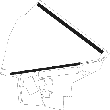
Harringworth - Spanhoe
Airport details
| Country | United Kingdom |
| State | England |
| Region | |
| Airspace | London Ctr |
| Municipality | North Northamptonshire |
| Elevation | 347ft (106m) |
| Timezone | GMT +0 |
| Coordinates | 52.55828, -0.62000 |
| Magnetic var | |
| Type | land |
| Available since | X-Plane v10.40 |
| ICAO code | XEG004F |
| IATA code | n/a |
| FAA code | n/a |
Communication
Nearby Points of Interest:
Deene Park
-RAF North Luffenham
-Walcot Hall
-St Mary the Virgin's Church, Ayston
-Stockerston Hall
-Lyveden New Bield
-Oundle railway station
-Wansford Pasture
-Kings Mill
-Browne's Hospital
-Stamford Town Hall
-Catmose House
-St Paul's Church, Stamford
-St Leonard's Priory, Stamford
-Boughton House
-Elton Hall
-Southorpe Paddock
-Barnwell Castle
-Launde Abbey
-Barnwell Manor
-Southorpe Meadow
-Drayton House
-Ufford Hall
-Cold Overton Hall And Adjoining Garden Walls
-Noseley Hall

Nearby beacons
| code | identifier | dist | bearing | frequency |
|---|---|---|---|---|
| WIT | WITTERING TACAN | 5.3 | 68° | 117.60 |
| LE | LEICESTER NDB | 15.4 | 277° | 383 |
| CIT | CRANFIELD NDB | 25.8 | 172° | 850 |
| EME | EAST MIDLANDS NDB | 26.6 | 296° | 353 |
| CWL | CRANWELL NDB | 28.5 | 16° | 423 |
| CWZ | CRANWELL TACAN | 28.6 | 16° | 117.40 |
| DTY | DAVENTRY VOR/DME | 29 | 233° | 116.40 |
| EMW | EAST MIDLANDS NDB | 34.4 | 288° | 393 |
| CGY | CONINGSBY TACAN | 35.9 | 40° | 111.10 |
| CAM | CAMBRIDGE NDB | 36 | 113° | 332 |
| WAD | WADDINGTON TACAN | 36.6 | 9° | 117.10 |
| LUT | LUTON NDB | 42 | 151° | 345 |
| MLD | MILDENHALL TACAN | 42.2 | 100° | 115.90 |
| BKY | BARKWAY VOR/DME | 42.3 | 130° | 116.25 |
| MAM | MARHAM TACAN | 43.4 | 86° | 108.70 |
| LKH | LAKENHEATH TACAN | 43.6 | 97° | 110.20 |
| WCO | WESTCOTT NDB | 44.1 | 206° | 335 |
| GAM | GAMSTON VOR/DME | 45 | 336° | 112.80 |
| HEN | HENTON NDB | 48.3 | 192° | 433 |
| BNN | BOVINGDON VOR/DME | 50 | 175° | 113.75 |
| OX | OXFORD NDB | 50.6 | 224° | 367 |
| BPK | BROOKMANS PARK VOR/DME | 52.1 | 148° | 117.50 |
| CHT | CHILTERN NDB | 56.2 | 174° | 277 |
| FNY | DONCASTER SHEFFIELD NDB | 56.7 | 337° | 338 |
| BSO | BENSON TACAN | 59.3 | 207° | 110 |
| BZ | BRIZE NORTON NDB | 60.5 | 231° | 386 |
| BZN | BRIZE NORTON TACAN | 60.6 | 231° | 111.90 |
| LAM | LAMBOURNE VOR/DME | 61.7 | 140° | 115.60 |
| WTZ | WATTISHAM TACAN | 62.9 | 106° | 109.30 |
| NWI | NORWICH NDB | 70 | 86° | 342 |
Disclaimer
The information on this website is not for real aviation. Use this data with the X-Plane flight simulator only! Data taken with kind consent from X-Plane 12 source code and data files. Content is subject to change without notice.