Causeway Coast And Glens - Plains
Airport details
| Country | United Kingdom |
| State | Northern Ireland |
| Region | |
| Airspace | Scottish Ctr |
| Municipality | County Antrim |
| Elevation | 157ft (48m) |
| Timezone | GMT +0 |
| Coordinates | 55.01421, -6.53858 |
| Magnetic var | |
| Type | land |
| Available since | X-Plane v10.40 |
| ICAO code | XEG0053 |
| IATA code | n/a |
| FAA code | n/a |
Communication
Nearby Points of Interest:
Town Hall The Diamond Coleraine Co.londonderry
-Causeway Coast and Glens
-Binevenagh
-Sperrins
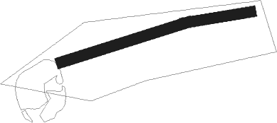
Runway info
Runway 07 / 25  | ||
| length | 205m (673ft) | |
| bearing | 82° / 262° | |
| width | 17m (55ft) | |
| surface | grass | |
| Runway 08 / 26 | ||
| length | 103m (338ft) | |
| bearing | 87° / 267° | |
| width | 17m (55ft) | |
| surface | grass | |
Nearby beacons
| code | identifier | dist | bearing | frequency |
|---|---|---|---|---|
| EGT | LONDONDERRY NDB | 21.3 | 273° | 328 |
| BEL | BELFAST VOR/DME | 23.7 | 139° | 117.20 |
| OY | BELFAST/ALDERGROVE NDB | 24.8 | 125° | 332 |
| HB | BELFAST CITY NDB | 33 | 121° | 420 |
| CBL | CAMPBELTOWN NDB | 38.5 | 64° | 380 |
| MAC | MACHRIHANISH VOR/DME | 39.3 | 65° | 116 |
| ISY | DME-ILS | 41.3 | 23° | 109.95 |
| LAY | ISLAY NDB | 41.3 | 23° | 395 |
Disclaimer
The information on this website is not for real aviation. Use this data with the X-Plane flight simulator only! Data taken with kind consent from X-Plane 12 source code and data files. Content is subject to change without notice.