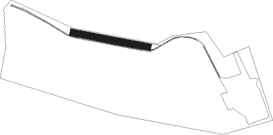
Burton Upon Trent - Rolleston Park Farm
Airport details
| Country | United Kingdom |
| State | England |
| Region | |
| Airspace | London Ctr |
| Municipality | East Staffordshire |
| Elevation | 271ft (83m) |
| Timezone | GMT +0 |
| Coordinates | 52.84143, -1.69089 |
| Magnetic var | |
| Type | land |
| Available since | X-Plane v10.40 |
| ICAO code | XEG3RP |
| IATA code | n/a |
| FAA code | n/a |
Communication
Nearby Points of Interest:
Burton upon Trent Town Hall
-Dovecliff Hall
-Monks Bridge
-Burton Abbey
-Dunstall Hall
-Walton Hall
-Repton Priory
-Brocksford Hall
-Bretby Hall
-Medieval settlement, including site of chapel and part of the open field system, immediately north east of Alkmonton Old Hall Fa
-Wychnor Hall
-Radbourne Hall
-Catton Hall
-Foremarke Hall
-Yeaveley Preceptory
-Croxall Hall
-Heath Wood barrow cemetery
-Ednaston Manor
-Swarkestone Bridge
-Derby Central School of Art
-Blithfield Hall
-Derby Central Library
-Old Grammar School
-County Hall
-Guildhall Theatre
Nearby beacons
| code | identifier | dist | bearing | frequency |
|---|---|---|---|---|
| TNL | TATENHILL NDB | 3.1 | 251° | 327 |
| EMW | EAST MIDLANDS NDB | 8.6 | 93° | 393 |
| TNT | TRENT VOR/DME | 12.7 | 6° | 115.70 |
| EME | EAST MIDLANDS NDB | 18 | 91° | 353 |
| BHX | BIRMINGHAM NDB | 23.3 | 189° | 406 |
| LE | LEICESTER NDB | 27.7 | 110° | 383 |
| WBA | WOLVERHAMPTON NDB | 28.5 | 240° | 356 |
| WOL | DME | 28.5 | 240° | 108.60 |
| HON | HONILEY VOR/DME | 29.1 | 177° | 113.65 |
| SWB | SHAWBURY VOR/DME | 35.3 | 267° | 116.80 |
| MCT | MANCHESTER VOR/DME | 37.1 | 312° | 113.55 |
| GAM | GAMSTON VOR/DME | 37.6 | 59° | 112.80 |
| WHI | WHITEGATE NDB | 39.4 | 290° | 368 |
| DTY | DAVENTRY VOR/DME | 44.9 | 139° | 116.40 |
| FNY | DONCASTER SHEFFIELD NDB | 45.4 | 47° | 338 |
| POL | POLE HILL VOR/DME | 56.1 | 335° | 112.10 |
| SBL | SHERBURN-IN-ELMET NDB | 59.5 | 27° | 323 |
| GST | GLOUCESTERSHIRE NDB | 59.6 | 207° | 331 |
| WCO | WESTCOTT NDB | 65.1 | 144° | 335 |
Disclaimer
The information on this website is not for real aviation. Use this data with the X-Plane flight simulator only! Data taken with kind consent from X-Plane 12 source code and data files. Content is subject to change without notice.