Camphill Farm - Camphill
Airport details
| Country | United Kingdom |
| State | England |
| Region | |
| Airspace | London Ctr |
| Municipality | Derbyshire Dales |
| Elevation | 1350ft (411m) |
| Timezone | GMT +0 |
| Coordinates | 53.30478, -1.72760 |
| Magnetic var | |
| Type | land |
| Available since | X-Plane v11.20 |
| ICAO code | XEG4CH |
| IATA code | n/a |
| FAA code | n/a |
Communication
| Camphill Camphill Base | 129.975 |
Nearby Points of Interest:
Highlow Hall
-Batham Gate
-Roman Catholic Church of St Michael
-Roman Catholic Church of Our Lady of Sorrows and Attached Presbytery
-Grindleford Bridge
-Stoke Hall, Derbyshire
-Church of All Saints, Hassop
-Thornbridge Hall
-Hordron Edge stone circle
-Holme Hall, Bakewell
-Bakewell railway station
-Bagshaw Hall
-Magpie, Dirty Red Soil, Maypit, Horsesteps and Great Red Soil lead mines and a limekiln, 590m south east of Johnson Lane Farm
-Deep Dale
-Burton Closes
-Sugworth Hall
-Lathkill Dale
-Fulwood Hall
-Stodhart Tunnel
-Conksbury Bridge
-Buxton Crescent
-St Anns Well
-Buxton Town Hall
-1-6, The Square
-Devonshire Dome
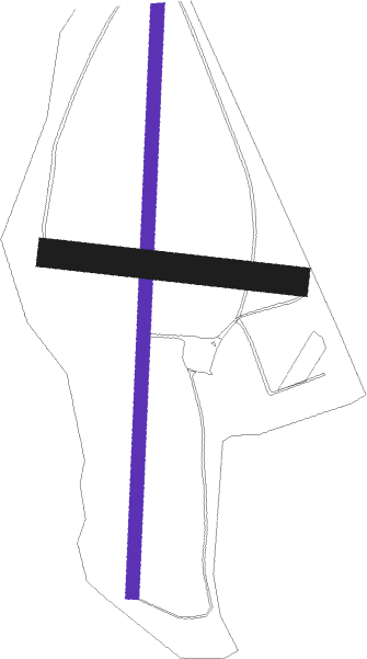
Runway info
| Runway 18 / 36 | ||
| length | 1040m (3412ft) | |
| bearing | 192° / 12° | |
| width | 23m (75ft) | |
| surface | grass | |
Runway 09 / 27  | ||
| length | 425m (1394ft) | |
| bearing | 97° / 277° | |
| width | 50m (164ft) | |
| surface | grass | |
Nearby beacons
| code | identifier | dist | bearing | frequency |
|---|---|---|---|---|
| TNT | TRENT VOR/DME | 15.2 | 167° | 115.70 |
| MCT | MANCHESTER VOR/DME | 19.4 | 276° | 113.55 |
| FNY | DONCASTER SHEFFIELD NDB | 27.9 | 77° | 338 |
| GAM | GAMSTON VOR/DME | 28 | 92° | 112.80 |
| TNL | TATENHILL NDB | 29.4 | 185° | 327 |
| POL | POLE HILL VOR/DME | 29.5 | 319° | 112.10 |
| EMW | EAST MIDLANDS NDB | 30.2 | 150° | 393 |
| WHI | WHITEGATE NDB | 32.9 | 262° | 368 |
| LBA | LEEDS BRADFORD NDB | 33.7 | 8° | 402 |
| EME | EAST MIDLANDS NDB | 34.2 | 132° | 353 |
| SBL | SHERBURN-IN-ELMET NDB | 34.5 | 47° | 323 |
| LPL | LIVERPOOL NDB | 35.8 | 272° | 349 |
| SWB | SHAWBURY VOR/DME | 45.4 | 242° | 116.80 |
| LE | LEICESTER NDB | 48.8 | 135° | 383 |
| BHX | BIRMINGHAM NDB | 51 | 182° | 406 |
| WBA | WOLVERHAMPTON NDB | 51.1 | 214° | 356 |
| WOL | DME | 51.1 | 214° | 108.60 |
| HON | HONILEY VOR/DME | 56.9 | 176° | 113.65 |
| LEE | LEEMING TACAN | 59.9 | 11° | 112.60 |
Disclaimer
The information on this website is not for real aviation. Use this data with the X-Plane flight simulator only! Data taken with kind consent from X-Plane 12 source code and data files. Content is subject to change without notice.