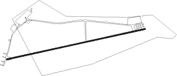
Trefnant - Lleweni Parc
Airport details
| Country | United Kingdom |
| State | Wales |
| Region | |
| Airspace | London Ctr |
| Municipality | St Asaph |
| Elevation | 133ft (41m) |
| Timezone | GMT +0 |
| Coordinates | 53.20990, -3.39277 |
| Magnetic var | |
| Type | land |
| Available since | X-Plane v10.40 |
| ICAO code | XEG7LP |
| IATA code | n/a |
| FAA code | n/a |
Communication
Nearby Points of Interest:
Plas Clough
-North Wales Hospital
-Foxhall Newydd
-Dolbelidr
-Galltfaenan Hall
-Wigfair Hall
-Church of St. Cwyfan
-Rhydonnen
-Ty Coch Cruck Barn, Llangynhafal, Denbighshire
-Plas-y-Ward
-Bodrhyddan Hall
-Kinmel Hall
-Cross In Churchyard Of The Church Of St Michael & All Angels
-The Old Rectory, Llanbedr
-Alyn Valley Woods and Alyn Gorge Caves
-Seven Eyes
-Peers Memorial
-The Old Court House
-The Old Mill, Ruthin
-Siop Nain
-Nantclwyd y Dre
-Ruthin Castle
-Rose Cottage, Ruthin
-Plas Coch, Ruthin
-Ruthin Town Hall
Nearby beacons
| code | identifier | dist | bearing | frequency |
|---|---|---|---|---|
| WAL | WALLASEY VOR/DME | 14.3 | 55° | 114.10 |
| HAW | HAWARDEN NDB | 14.9 | 94° | 340 |
| LPL | LIVERPOOL NDB | 25.2 | 79° | 349 |
| WHI | WHITEGATE NDB | 27.7 | 92° | 368 |
| WPL | WELSHPOOL NDB | 35.8 | 158° | 323 |
| SWB | SHAWBURY VOR/DME | 36.1 | 119° | 116.80 |
| BPL | BLACKPOOL NDB | 36.2 | 33° | 318 |
| WTN | WARTON TACAN | 36.7 | 44° | 113.20 |
| WTN | WARTON NDB | 37.8 | 45° | 337 |
| WL | BARROW (WALNEY ISLAND) NDB | 55.2 | 8° | 385 |
| SH | SHOBDON NDB | 60.9 | 152° | 426 |
Disclaimer
The information on this website is not for real aviation. Use this data with the X-Plane flight simulator only! Data taken with kind consent from X-Plane 12 source code and data files. Content is subject to change without notice.