Abbeyfeale
Airport details
| Country | Ireland |
| State | [Other] |
| Region | |
| Airspace | Shannon Ctr |
| Municipality | Listowel Municipal District |
| Elevation | 297ft (91m) |
| Timezone | GMT +0 |
| Coordinates | 52.39539, -9.34566 |
| Magnetic var | |
| Type | land |
| Available since | X-Plane v10.30 |
| ICAO code | XEI0002 |
| IATA code | n/a |
| FAA code | n/a |
Communication
Nearby Points of Interest:
Ballymalis Castle
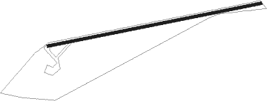
Runway info
| Runway 08 / 26 | ||
| length | 759m (2490ft) | |
| bearing | 86° / 266° | |
| width | 10m (33ft) | |
| surface | asphalt | |
Nearby beacons
| code | identifier | dist | bearing | frequency |
|---|---|---|---|---|
| FOY | FOYNES NDB | 11.6 | 41° | 395 |
| KER | KERRY NDB | 14.3 | 220° | 334 |
| SHA | SHANNON VOR/DME | 25.7 | 55° | 113.30 |
| OL | SHANNON NDB | 28.5 | 56° | 339 |
| CRK | CORK VOR/DME | 45.7 | 123° | 114.60 |
Disclaimer
The information on this website is not for real aviation. Use this data with the X-Plane flight simulator only! Data taken with kind consent from X-Plane 12 source code and data files. Content is subject to change without notice.