Setermoen
Airport details
| Country | Norway |
| State | [Other] |
| Region | |
| Airspace | Polaris Ctr |
| Municipality | Bardu |
| Elevation | 269ft (82m) |
| Timezone | GMT +1 |
| Coordinates | 68.85803, 18.34725 |
| Magnetic var | |
| Type | land |
| Available since | X-Plane v10.40 |
| ICAO code | XEN000V |
| IATA code | n/a |
| FAA code | n/a |
Communication
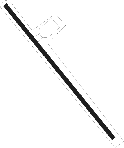
Runway info
| Runway 14 / 32 | ||
| length | 455m (1493ft) | |
| bearing | 118° / 298° | |
| width | 11m (36ft) | |
| surface | grass | |
Nearby beacons
| code | identifier | dist | bearing | frequency |
|---|---|---|---|---|
| BAR | BARDUFOSS TACAN | 12.3 | 52° | 113.40 |
| BDF | BARDUFOSS VOR/DME | 12.6 | 30° | 114.20 |
| TIL | TILLER NDB | 18.1 | 80° | 350 |
| SJA | SENJA NDB | 21.5 | 300° | 414 |
| KBV | KOBBE (TROMSO) NDB | 40.1 | 36° | 283 |
| TRO | TROMSO VOR/DME | 52.5 | 38° | 113.80 |
| KV | KVALSUND (TROMSO) NDB | 58.9 | 35° | 362 |
Disclaimer
The information on this website is not for real aviation. Use this data with the X-Plane flight simulator only! Data taken with kind consent from X-Plane 12 source code and data files. Content is subject to change without notice.