Airports for X-Plane offers a convenient way to explore airports and their related communication information for the X-Plane flight simulator. It only uses data from the X-Plane flight simulator itself, and is therefore more reliable than the data that comes from real aviation websites. You can search for airports by using the ICAO code, or browse for airports per country and state. The information displayed is categorized by airport details, runway information, airport communication, approach frequencies (ILS and Glidepath details), details of nearby beacons, SIDs, STARs and approach procedures.

traffic airport apron transit helicopters frankfurt airport flight asphalt hangar commuter airfield airspace automated airport weather station ferry non-towered airport faa luggage buildings military station warfare

Jabłonna - Kakolewo

Airport details

CountryPoland
StateGreater Poland Voivodeship
Region
AirspaceWarsaw Ctr
Municipalitygmina Grodzisk Wielkopolski
Elevation298ft (91m)
TimezoneGMT +1
Coordinates52.23750, 16.22745
Magnetic var
Typeland
Available sinceX-Plane v10.40
ICAO codeXEP87
IATA coden/a
FAA coden/a

Communication

Kakolewo Kakolewo-Radio122.900
Nearby Points of Interest:
Church of the Immaculate Heart of Mary in Kąkolewo
-
1 Żwirki i Wigury Street in Grodzisk Wielkopolski
-
5 Kolejowa Street in Grodzisk Wielkopolski
-
1 Szeroka Street in Grodzisk Wielkopolski
-
Grodzisk Wielkopolski town hall
-
Studnia św. Bernarda w Grodzisku Wielkopolskim
-
Old town hall in Nowy Tomyśl
-
Rostarzewo town hall
-
Kościół Matki Boskiej Nieustającej Pomocy w Rostarzewie
-
Wąsowo Castle
-
Staropolska Inn in Ptaszkowo
-
Saints Peter and Paul church in Ptaszkowo
-
Town Hall in Opalenica
-
Kościół Narodzenia Najświętszej Maryi Panny w Wielichowie
-
Palace in Parzęczewo
-
Kościół św. Mikołaja w Zbąszyniu
-
Castle in Zbąszyń
-
Pałac w Granówku
-
Saint James church in Obra
-
Kościół poewangelicki w Lwówku
-
Former Holy Spirit Hospital
-
Posadowo Palace
-
Kościół Świętego Krzyża w Lwówku
-
Opactwo Cystersów w Przemęcie
-
Palace in Strykowo

Runway info

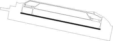
Runway 11 / 29
 length2294m (7526ft)
 bearing100° / 280°
 width29m (95ft)
 surfaceconcrete

Airport layout


Parking locations

Nearby beacons

codeidentifierdistbearingfrequency
ZLGZIELONA GORA VOR/DME16.7257°110.65
CMPCZEMPIN VOR/DME19.1102°114.50
LAWLAWICA (POZNAN) VOR/DME24.773°115.80
TKSKRZESINY (POZNAN) TACAN27.783°111.50
NKKRZESINY (POZNAN) NDB28.684°489
DREDME37.6326°115.30
TBNGORNY DME66.9137°113.60

Disclaimer

The information on this website is not for real aviation. Use this data with the X-Plane flight simulator only! Data taken with kind consent from X-Plane 12 source code and data files. Content is subject to change without notice.