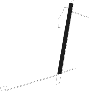
Airports for X-Plane offers a convenient way to explore airports and their related communication information for the X-Plane flight simulator. It only uses data from the X-Plane flight simulator itself, and is therefore more reliable than the data that comes from real aviation websites. You can search for airports by using the ICAO code, or browse for airports per country and state. The information displayed is categorized by airport details, runway information, airport communication, approach frequencies (ILS and Glidepath details), details of nearby beacons, SIDs, STARs and approach procedures.

stolport capital airport hospital runway lighting flight attendant heliport airfield traffic pattern pilot grass stol aircraft carrier train station aerodromes airbus aviation airplane stopover nation warfare

Timmele

Airport details

CountrySweden
State[Other]
Region
AirspaceSweden Ctr
MunicipalityUlricehamns kommun
Elevation605ft (184m)
TimezoneGMT +1
Coordinates57.87047, 13.42932
Magnetic var
Typeland
Available sinceX-Plane v10.40
ICAO codeXESG1
IATA coden/a
FAA coden/a

Communication

Timmele COM freq123.650
Nearby Points of Interest:
Timmele socken
-
Dalums socken
-
Västergötlands runinskrifter 197
-
Böne socken
-
Hällstads socken
-
Vinsarp
-
Möne socken
-
Blidsberg socken
-
Knätte socken
-
Hössna socken
-
Södra Vånga socken
-
Ulricehamns station
-
Vattenverket i Ulricehamn
-
Ulricehamns stad
-
Murums socken
-
Kärråkra socken
-
Humla socken
-
Härna socken
-
Södra Vings socken
-
Gullereds socken
-
Liareds socken
-
Öra socken
-
Börstigs socken
-
Kölaby socken
-
Västergötlands runinskrifter 180

Runway info

Runway 01 / 19
 length521m (1709ft)
 bearing25° / 205°
 width28m (92ft)
 surfacegrass

Airport layout


Nearby beacons

codeidentifierdistbearingfrequency
SDHDME19.9259°115.65
JONJONKOPING VOR/DME21.3100°115.80
OAJONKOPING NDB21.994°338
OJJONKOPING NDB21.9106°403
SSSKOVDE NDB31.246°390
SGSATENAS NDB38.2305°409
LGSATENAS NDB41.7309°309
NSSKOVDE NDB43.341°384
KBGKARLSBORG NDB47.557°312

Disclaimer

The information on this website is not for real aviation. Use this data with the X-Plane flight simulator only! Data taken with kind consent from X-Plane 12 source code and data files. Content is subject to change without notice.