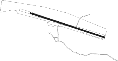
Knivsta - Vassunda
Airport details
| Country | Sweden |
| State | [Other] |
| Region | |
| Airspace | Sweden Ctr |
| Municipality | Knivsta kommun |
| Elevation | 44ft (13m) |
| Timezone | GMT +1 |
| Coordinates | 59.72289, 17.71457 |
| Magnetic var | |
| Type | land |
| Available since | X-Plane v10.40 |
| ICAO code | XESS4 |
| IATA code | n/a |
| FAA code | n/a |
Communication
Nearby Points of Interest:
Uppland Runic Inscription 479
-Alsike socken
-Uppland Runic Inscription Fv1948;168
-Vassunda socken
-Uppland Runic Inscription 462
-Upplands runinskrifter 474
-Uppland Runic Inscription 463
-Ängby stone
-Uppland Runic Inscription 471
-Uppland Runic Inscription 460
-Knivsta socken
-Upplands runinskrifter 470
-Sigtuna city municipality
-Uppland Runic Inscription 678
-Uppland Runic Inscription 679
-Skoklosters socken
-Haga socken
-Uppland Runic Inscription 684
-Uppland Runic Inscription 685
-Dalby socken
-Uppland Runic Inscription 486
-Uppland Runic Inscription 485
-Uppland Runic Inscription 448
-Uppsala-Näs socken
-Odensala socken
Nearby beacons
| code | identifier | dist | bearing | frequency |
|---|---|---|---|---|
| ANW | (STOCKHOLM) DME | 4.2 | 94° | 112.05 |
| ARL | ARLANDA (STOCKHOLM) VOR/DME | 7.3 | 109° | 116 |
| WA | ARLANDA (STOCKHOLM) NDB | 7.3 | 108° | 348 |
| ASW | (STOCKHOLM) DME | 8.7 | 142° | 113.75 |
| ASE | (STOCKHOLM) DME | 8.9 | 109° | 114.45 |
| ANE | (STOCKHOLM) DME | 10.6 | 95° | 113.30 |
| LNA | LENA NDB | 15.4 | 243° | 330 |
| UP | UPPSALA NDB | 15.4 | 356° | 366 |
| TEB | TEBBY VOR/DME | 18.7 | 111° | 117.10 |
| ERK | ERKEN NDB | 21.4 | 74° | 383 |
| COR | CORNER NDB | 28.5 | 207° | 388 |
| HMR | HAMMAR VOR/DME | 39.1 | 51° | 112.60 |
| TRS | TROSA VOR/DME | 47.5 | 195° | 114.30 |
| PEO | SKAVSTA (STOCKHOLM) NDB | 59.3 | 216° | 398 |
| NW | SKAVSTA (STOCKHOLM) NDB | 63.2 | 225° | 364 |
Disclaimer
The information on this website is not for real aviation. Use this data with the X-Plane flight simulator only! Data taken with kind consent from X-Plane 12 source code and data files. Content is subject to change without notice.