Airports for X-Plane offers a convenient way to explore airports and their related communication information for the X-Plane flight simulator. It only uses data from the X-Plane flight simulator itself, and is therefore more reliable than the data that comes from real aviation websites. You can search for airports by using the ICAO code, or browse for airports per country and state. The information displayed is categorized by airport details, runway information, airport communication, approach frequencies (ILS and Glidepath details), details of nearby beacons, SIDs, STARs and approach procedures.

hospital international airport aircraft gravel flown airport terminal control tower stolport taxi automated airport weather station flight attendant commuter transit public transport frankfurt airport train airstrip jet newark air traffic control

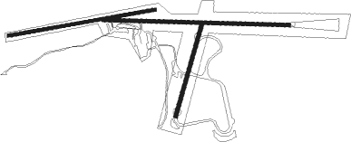
Järpen - Åre Molanda

Airport details

CountrySweden
State[Other]
Region
AirspaceSweden Ctr
MunicipalityÅre kommun
Elevation1029ft (314m)
TimezoneGMT +1
Coordinates63.32888, 13.41678
Magnetic var
Typeland
Available sinceX-Plane v10.32
ICAO codeXESU3
IATA coden/a
FAA coden/a

Communication

No airport communication available for XESU3
Nearby Points of Interest:
Undersåkers kyrka
-
Mörsils socken
-
Kalls socken
-
Åre socken
-
Åre Bergbana
-
Mattmars socken
-
Alsen (Jämtland)
-
Glösa
-
Offerdal
-
Petroglyphs of Gärde

Runway info

Runway 09 / 27  
 length852m (2795ft)
 bearing93° / 273°
 width18m (59ft)
 surfaceasphalt
Runway 08 / 26  
 length685m (2247ft)
 bearing87° / 267°
 width15m (49ft)
 surfacedirt
Runway 02 / 20  
 length446m (1463ft)
 bearing39° / 219°
 width18m (59ft)
 surfaceasphalt

Airport layout


Disclaimer

The information on this website is not for real aviation. Use this data with the X-Plane flight simulator only! Data taken with kind consent from X-Plane 12 source code and data files. Content is subject to change without notice.