Airports for X-Plane offers a convenient way to explore airports and their related communication information for the X-Plane flight simulator. It only uses data from the X-Plane flight simulator itself, and is therefore more reliable than the data that comes from real aviation websites. You can search for airports by using the ICAO code, or browse for airports per country and state. The information displayed is categorized by airport details, runway information, airport communication, approach frequencies (ILS and Glidepath details), details of nearby beacons, SIDs, STARs and approach procedures.

takeoff air traffic control capital airport authority traffic helipad aircraft carrier hotel nearby taxiway luggage arriving airfield traffic pattern aerodromes airports gravel airspeed field international warfare

Stenstorp - Motala Skärstad

Airport details

CountrySweden
State[Other]
Region
AirspaceSweden Ctr
MunicipalityMotala kommun
Elevation340ft (104m)
TimezoneGMT +1
Coordinates58.48824, 15.10155
Magnetic var
Typeland
Available sinceX-Plane v10.40
ICAO codeXESV3
IATA coden/a
FAA coden/a

Communication

No airport communication available for XESV3
Nearby Points of Interest:
Västra Stenby kyrka
-
Västra Stenby socken
-
Östergötland Runic Inscription 8
-
Vinnerstads kyrka
-
Varvs socken
-
Ask socken
-
Styra socken
-
Motala hus
-
Motala socken
-
Motala stad
-
Ekebyborna socken
-
Vallerstads socken
-
Fornåsa socken
-
Östergötlands runinskrifter 35
-
Östergötlands runinskrifter 36
-
Hagebyhöga socken
-
Östergötlands runinskrifter 1
-
Fivelstads socken
-
Östergötlands runinskrifter 38
-
Lönsås socken
-
Skeppsås socken
-
Östergötlands runinskrifter 166
-
Östergötlands runinskrifter N272
-
Östergötlands runinskrifter 62
-
Skänninge Abbey

Runway info

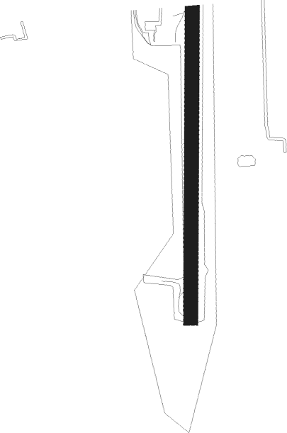
Runway 01 / 19
 length772m (2533ft)
 bearing9° / 189°
 width35m (115ft)
 surfacegrass

Airport layout


Nearby beacons

codeidentifierdistbearingfrequency
SCSAAB (LINKOPING) NDB14.597°300
LCFMALMEN (LINKOPING) NDB15.4114°285
VSNVASSEN VOR/DME22.1107°115.25
KBGKARLSBORG NDB22.6270°312
OLSAAB (LINKOPING) NDB2399°415
RBOREBRO NDB38.9351°375
ENOREBRO NDB48.2357°400
OAJONKOPING NDB50.5236°338

Disclaimer

The information on this website is not for real aviation. Use this data with the X-Plane flight simulator only! Data taken with kind consent from X-Plane 12 source code and data files. Content is subject to change without notice.