Wellington - Diemerskraal
Airport details
| Country | South Africa |
| State | Western Cape |
| Region | |
| Airspace | Cape Town Ctr |
| Municipality | Drakenstein Local Municipality |
| Elevation | 296ft (90m) |
| Timezone | GMT +2 |
| Coordinates | -33.57918, 18.91565 |
| Magnetic var | |
| Type | land |
| Available since | X-Plane v11.40 |
| ICAO code | XFA0008 |
| IATA code | n/a |
| FAA code | n/a |
Communication
Nearby Points of Interest:
Bain's Kloof Pass
-Boschendal
-Groot Winterhoek
-Rondebosch Common
-Groote Schuur Hospital
-Martin Melck House
-Cape Town City Hall
-National Library of South Africa
-Tuynhuys
-Rust en Vreugd
-Huguenot Memorial Building
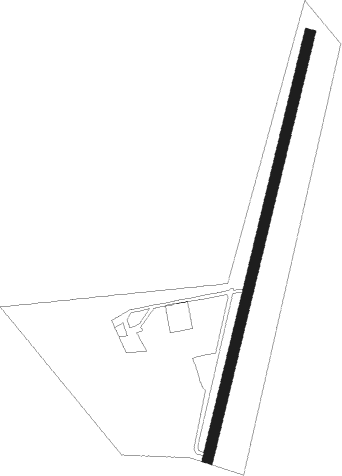
Runway info
| Runway 04 / 22 | ||
| length | 841m (2759ft) | |
| bearing | 21° / 201° | |
| width | 20m (66ft) | |
| surface | dirt | |
| blast zone | 0m (0ft) / 25m (82ft) | |
Nearby beacons
| code | identifier | dist | bearing | frequency |
|---|---|---|---|---|
| CB | CAPE TOWN NDB | 24.7 | 229° | 462 |
| WC | WORCESTER NDB | 25.5 | 100° | 335 |
| CTV | CAPE TOWN VOR/DME | 28.1 | 218° | 115.70 |
| SVV | SOMERSVELD VOR | 29.5 | 307° | 113 |
| RIV | ROBBEN ISLAND VOR/DME | 30.5 | 248° | 117.60 |
| CSV | CERES VOR/DME | 32.7 | 58° | 114.20 |
| CDV | CALEDON VOR | 42.5 | 134° | 114.90 |
| LWV | LANGEBAANWEG VOR/DME | 52 | 308° | 117 |
| LW | LANGEBAANWEG NDB | 52.6 | 308° | 345 |
Disclaimer
The information on this website is not for real aviation. Use this data with the X-Plane flight simulator only! Data taken with kind consent from X-Plane 12 source code and data files. Content is subject to change without notice.