Mirandilla - Merida - Royanejos
Airport details
| Country | Spain |
| State | Extremadura |
| Region | |
| Airspace | Madrid Ctr |
| Municipality | Mérida |
| Elevation | 882ft (269m) |
| Timezone | GMT +1 |
| Coordinates | 38.98004, -6.34519 |
| Magnetic var | |
| Type | land |
| Available since | X-Plane v10.40 |
| ICAO code | XFP0002 |
| IATA code | n/a |
| FAA code | n/a |
Communication
| Merida - Royanejos unnamed entity | 130.125 |
Nearby Points of Interest:
Biblioteca Pública del Estado en Mérida - Jesús Delgado Valhondo
-iglesia parroquial de Santa María. Guareña
-Castillo de Castellanos, de Mohedano o de Moheda
-Plaza de toros de Almendralejo
-edificio del Obrero Extremeño
-Castle of Mayoralgo
-Castillo de Villalba de los Barros
-iglesia parroquial Nuestra Señora de la Candelaria
-Conjunto Histórico Fuente del Maestre
-iglesia de la Purísima Concepción
-Puente de Cantillana
-Palacio de los Málaga
-Palacio de las Veletas
-Casa Mudéjar de la Cuesta de Aldana
-old town of Cáceres
-Palacio de los Toledo-Moctezuma
-Palacio de la Isla, Cáceres
-Casa de los Trucos
-Recinto abaluartado de Badajoz
-Museo de Bellas Artes de Badajoz
-Archivo Histórico Provincial de Badajoz
-Plaza de toros de Cáceres
-Convento de Santa María de la Parra
-Convento de Santa Clara de la Parra
Runway info
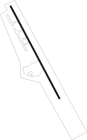
| Runway 16 / 34 | ||
| length | 647m (2123ft) | |
| bearing | 151° / 331° | |
| width | 10m (31ft) | |
| surface | asphalt | |
Nearby beacons
| code | identifier | dist | bearing | frequency |
|---|---|---|---|---|
| VBZ | BADAJOZ VOR/DME | 22.6 | 259° | 116.80 |
| TBC | BADAJOZ TACAN | 22.7 | 259° | 108.80 |
| CCS | CACERES VOR/DME | 32.9 | 351° | 114.20 |
Disclaimer
The information on this website is not for real aviation. Use this data with the X-Plane flight simulator only! Data taken with kind consent from X-Plane 12 source code and data files. Content is subject to change without notice.