Tichit
Airport details
| Country | Mauritania |
| State | Tagant |
| Region | GQ |
| Airspace | Dakar Ctr |
| Municipality | Tichit |
| Elevation | 561ft (171m) |
| Timezone | GMT +0 |
| Coordinates | 18.43333, -9.48333 |
| Magnetic var | |
| Type | land |
| Available since | X-Plane v10.40 |
| ICAO code | XGQ0002 |
| IATA code | THI |
| FAA code | n/a |
Communication
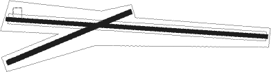
Runway info
Runway 11 / 29  | ||
| length | 2662m (8734ft) | |
| bearing | 98° / 278° | |
| width | 40m (131ft) | |
| surface | gravel | |
| Runway 08 / 26 | ||
| length | 1343m (4406ft) | |
| bearing | 73° / 253° | |
| width | 50m (164ft) | |
| surface | gravel | |
Disclaimer
The information on this website is not for real aviation. Use this data with the X-Plane flight simulator only! Data taken with kind consent from X-Plane 12 source code and data files. Content is subject to change without notice.