Ceres - Freefall Oz
Airport details
| Country | United States of America |
| State | Pennsylvania |
| Region | |
| Airspace | Cleveland Ctr |
| Municipality | Ceres Township |
| Elevation | 1438ft (438m) |
| Timezone | GMT -5 |
| Coordinates | 41.99568, -78.28862 |
| Magnetic var | |
| Type | land |
| Available since | X-Plane v10.40 |
| ICAO code | XK002W |
| IATA code | n/a |
| FAA code | 06PA |
Communication
Nearby Points of Interest:
Portville Free Library
-William E. Wheeler House
-Pfeiffer-Wheeler American Chestnut Cabin
-Conklin Mountain House
-Beardsley-Oliver House
-Olean Armory
-United States Post Office
-Olean School No. 10
-Union and State Streets Historic District
-House at 520 Hostageh Road
-Randolph Historic District
-Lynn Hall
-McKinney Stables of Empire City Farms
-South Street Historic District
-Main Street Historic District
-Friendship Free Library
-Crook Farm
-Bradford Old City Hall
-Rufus Barrett Stone House
-Bradford Downtown Historic District
-Bradford Armory
-Belmont Grange No. 1243
-Belmont Literary and Historical Society Free Library
-Coudersport Historic District
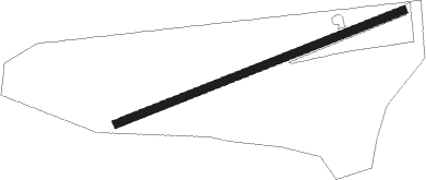
Runway info
| Runway 08 / 26 | ||
| length | 887m (2910ft) | |
| bearing | 77° / 257° | |
| width | 24m (80ft) | |
| surface | grass | |
Nearby beacons
| code | identifier | dist | bearing | frequency |
|---|---|---|---|---|
| ELZ | DME | 14 | 72° | 111.40 |
| BFD | DME | 19.4 | 238° | 116.60 |
| SLT | SLATE RUN VORTAC | 32.3 | 147° | 113.90 |
| JHW | JAMESTOWN VOR/DME | 38.8 | 283° | 114.70 |
| SFK | STONYFORK VOR/DME | 42.8 | 109° | 108.60 |
| ETG | KEATING VORTAC | 47.3 | 169° | 116 |
| DKK | DME | 52.9 | 297° | 116.20 |
| GEE | GENESEO VOR/DME | 56 | 34° | 108.20 |
| GB | PLAZZ (BUFFALO) NDB | 57.6 | 329° | 204 |
| BUF | BUFFALO VOR/DME | 58.2 | 339° | 116.40 |
Disclaimer
The information on this website is not for real aviation. Use this data with the X-Plane flight simulator only! Data taken with kind consent from X-Plane 12 source code and data files. Content is subject to change without notice.