Happy Canyon
Airport details
| Country | United States of America |
| State | Utah |
| Region | |
| Airspace | Salt Lake City Ctr |
| Municipality | Wayne County |
| Elevation | 4934ft (1504m) |
| Timezone | GMT -7 |
| Coordinates | 38.16000, -110.29000 |
| Magnetic var | |
| Type | land |
| Available since | X-Plane v10.40 |
| ICAO code | XK0086 |
| IATA code | n/a |
| FAA code | UT97 |
Communication
Nearby Points of Interest:
Horseshoe Canyon Archeological District
-Lost Canyon Cowboy Camp
-Cave Springs Cowboy Camp
-Denis Julien Inscription
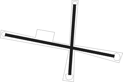
Runway info
Runway 09 / 27  | ||
| length | 630m (2067ft) | |
| bearing | 102° / 282° | |
| width | 15m (50ft) | |
| surface | dirt | |
| Runway 18 / 36 | ||
| length | 393m (1289ft) | |
| bearing | 191° / 11° | |
| width | 15m (50ft) | |
| surface | dirt | |
Nearby beacons
| code | identifier | dist | bearing | frequency |
|---|---|---|---|---|
| HVE | HANKSVILLE VORTAC | 24.7 | 302° | 115.90 |
| OAB | MOAB VOR/DME | 43.9 | 42° | 109.80 |
| BDG | BLANDING NDB | 54 | 129° | 340 |
Disclaimer
The information on this website is not for real aviation. Use this data with the X-Plane flight simulator only! Data taken with kind consent from X-Plane 12 source code and data files. Content is subject to change without notice.