Fayetteville - Fayette
Airport details
| Country | United States of America |
| State | West Virginia |
| Region | |
| Airspace | Indianapolis Ctr |
| Municipality | Fayetteville |
| Elevation | 1958ft (597m) |
| Timezone | GMT -5 |
| Coordinates | 38.02393, -81.12130 |
| Magnetic var | |
| Type | land |
| Available since | X-Plane v10.40 |
| ICAO code | XKWV59 |
| IATA code | n/a |
| FAA code | n/a |
Communication
| Fayette CTAF/UNICOM | 122.800 |
Nearby Points of Interest:
Fayetteville Historic District
-Fayette County Courthouse
-E. B. Hawkins House
-Oak Hill Railroad Depot
-Nuttallburg Coal Mining Complex and Town Historic District
-Whipple Company Store
-Bank of Glen Jean
-Contentment
-Page-Vawter House
-New River Company General Office Building
-Mount Hope Historic District
-Gauley Bridge Railroad Station
-Prince Brothers General Store
-Main Building
-Beckley Courthouse Square Historic District
-Beckley Feed and Hardware Company
-Wildwood
-Little Beaver Dam
-Cedar Grove
-Nicholas County Courthouse
-Old Main
-Sophia Historic District
-Nicholas County Bank
-Trump-Lilly Farmstead
-Deitz Farm
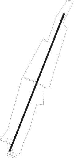
Runway info
| Runway 3 / 21 | ||
| length | 633m (2077ft) | |
| bearing | 32° / 212° | |
| width | 6m (20ft) | |
| surface | asphalt | |
| displ threshold | 39m (128ft) / 34m (112ft) | |
Nearby beacons
| code | identifier | dist | bearing | frequency |
|---|---|---|---|---|
| BKW | BECKLEY VOR/DME | 14.6 | 181° | 117.70 |
| RNL | RAINELLE VOR | 15.1 | 99° | 116.60 |
| LW | BUSHI (LEWISBURG) NDB | 34.1 | 110° | 346 |
| LWB | DME | 35.8 | 102° | 116.05 |
| HVQ | CHARLESTON VOR/DME | 36.3 | 297° | 117.40 |
| BLF | BLUEFIELD VOR/DME | 43.2 | 186° | 110 |
| PSK | PULASKI (DUBLIN) VORTAC | 59.4 | 156° | 116.80 |
| TEC | TECH (BLACKSBURG) NDB | 59.6 | 139° | 368 |
| HNN | DME | 61.1 | 309° | 115.90 |
Disclaimer
The information on this website is not for real aviation. Use this data with the X-Plane flight simulator only! Data taken with kind consent from X-Plane 12 source code and data files. Content is subject to change without notice.