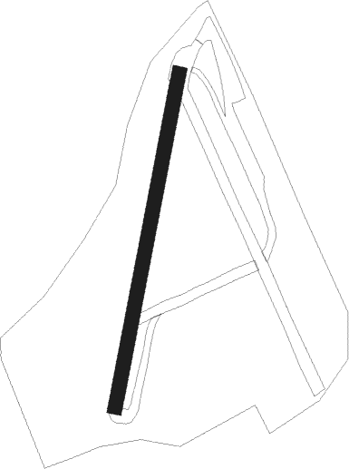
Benejama - Biar Beneixama
Airport details
| Country | Spain |
| State | Valencian Community |
| Region | |
| Airspace | Barcelona Ctr |
| Municipality | Biar |
| Elevation | 1935ft (590m) |
| Timezone | GMT +1 |
| Coordinates | 38.68256, -0.76162 |
| Magnetic var | |
| Type | land |
| Available since | X-Plane v10.40 |
| ICAO code | XLE0005 |
| IATA code | n/a |
| FAA code | n/a |
Communication
| Biar Beneixama Benejama Radio | 130.125 |
Runway info
| Runway 02 / 20 | ||
| length | 391m (1283ft) | |
| bearing | 19° / 199° | |
| width | 16m (52ft) | |
| surface | dirt | |
Nearby beacons
| code | identifier | dist | bearing | frequency |
|---|---|---|---|---|
| AI | ALICANTE NDB | 23.6 | 165° | 330 |
| ATE | ALICANTE VOR/DME | 25.1 | 156° | 114.65 |
| ALT | ALTET VOR/DME | 26.4 | 155° | 113.80 |
| PND | PINEDO (VALENCIA) NDB | 49.2 | 29° | 340 |
| TRL | ALCANTARILLA (MURCIA) TACAN | 49.2 | 213° | 116.60 |
| VLC | VALENCIA VOR/DME | 49.9 | 19° | 116.10 |
| VSJ | SAN JAVIER VORTAC | 54.2 | 183° | 113 |
| MUR | MURCIA VOR/DME | 55.5 | 202° | 114.85 |
| EBT | BETERA NDB | 58.2 | 17° | 362 |
| SGO | SAGUNTO (VALENCIA) NDB | 64.8 | 29° | 356 |
Disclaimer
The information on this website is not for real aviation. Use this data with the X-Plane flight simulator only! Data taken with kind consent from X-Plane 12 source code and data files. Content is subject to change without notice.
