Alcazarén - Alcazaren
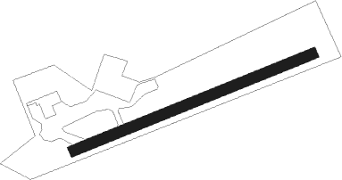
Airport details
| Country | Spain |
| State | Castile and León |
| Region | LE |
| Airspace | Madrid Ctr |
| Municipality | Alcazarén |
| Elevation | 2131ft (650m) |
| Timezone | GMT +1 |
| Coordinates | 41.37149, -4.69850 |
| Magnetic var | |
| Type | land |
| Available since | X-Plane v10.30 |
| ICAO code | XLE000D |
| IATA code | n/a |
| FAA code | n/a |
Communication
| Alcazaren unnamed entity | 123.425 |
Nearby Points of Interest:
Church of San Miguel Arcángel, Hornillos de Eresma
-Monastery of Santa María de la Mejorada
-Church of San Martín de Tours, Cogeces de Íscar
-Tower of Pozal de Gallinas
-Reales Carnicerías, Medina del Campo
-Casa Blanca, Medina del Campo
-Church of San Miguel del Pino
-Church of Nuestra Señora de la Asunción, Tudela de Duero
-Archivo General de Simancas
-Castle of Foncastín
-Tordesillas
-Iglesia de San Juan Bautista, Palacios de Goda
-Castle of Fuente el Sol
-Valladolid locomotive depot
-Monastery of Nuestra Señora del Prado
-Edificio de la Electra Popular Vallisoletana
-Real Monasterio de San Joaquín y Santa Ana
-Pasaje Gutierrez
-Colegio Mayor Santa Cruz
-Church of Nuestra Señora del Pilar, Valladolid
-Valladolid
-Casa Consistorial de Valladolid
-Calle de Juan Mambrilla
-Cruz de Santo Domingo
-Convent of Santa Isabel de Hungría, Valladolid
Nearby beacons
| code | identifier | dist | bearing | frequency |
|---|---|---|---|---|
| NUB | VILLANUBLA (VALLADOLID) VOR/DME | 21.1 | 335° | 113.65 |
| AL | MATACAN (SALAMANCA) NDB | 39.5 | 246° | 359 |
| BBI | SALAMANCA VOR/DME | 40.3 | 245° | 112.20 |
| ZMR | ZAMORA VOR/DME | 43.4 | 280° | 117.10 |
| TSC | SALAMANCA TACAN | 44.1 | 243° | 113.30 |
| NEA | TABANERA VOR/DME | 47.4 | 42° | 116.75 |
| ECV | COLMENAR VIEJO NDB | 58.5 | 126° | 319 |
| CNR | COLMENAR VIEJO VOR/DME | 61.6 | 127° | 117.30 |
Disclaimer
The information on this website is not for real aviation. Use this data with the X-Plane flight simulator only! Data taken with kind consent from X-Plane 12 source code and data files. Content is subject to change without notice.