Mollina - Antequera
Airport details
| Country | Spain |
| State | Andalusia |
| Region | |
| Airspace | Madrid Ctr |
| Municipality | Antequera |
| Elevation | 1407ft (429m) |
| Timezone | GMT +1 |
| Coordinates | 37.10039, -4.56318 |
| Magnetic var | |
| Type | land |
| Available since | X-Plane v10.32 |
| ICAO code | XLE000F |
| IATA code | n/a |
| FAA code | n/a |
Communication
| Antequera unnamed entity | 129.975 |
Nearby Points of Interest:
Convento de la Madre de Dios de Monteagudo
-Palacio de Nájera
-Centro Histórico de Antequera
-Palacio de la Marquesa de las Escalonias
-Centro Histórico de Archidona
-Cueva del Toro
-Puente sobre el Río Genil
-Cueva de La Silera
-Fuente de Piedra Lagoon
-Cementerio de San Sebastián
-Abrigos de Peñas Cabrera
-Iglesia Parroquial de la Inmaculada Concepción
-Castle of Almogía
-Torre del Canuto
-Castillo-Palacio
-Centro Histórico de Carratraca
-Los Castillejos
-Necrópolis prehistórica de Hacho
-Castillo de Ortegícar
-Cisternas romanas
-Cueva del Boquete de Zafarraya (Alcaucín)
-Cerro de la Tortuga
-Iglesia de Nuestra Señora del Rosario
-Centro Cultural Provincial
-Castillo del Cerro de la Ermita
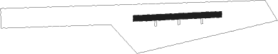
Runway info
| Runway 09 / 27 | ||
| length | 254m (833ft) | |
| bearing | 91° / 271° | |
| width | 17m (56ft) | |
| surface | asphalt | |
| displ threshold | 10m (33ft) / 0m (0ft) | |
| blast zone | 0m (0ft) / 69m (226ft) | |
Nearby beacons
| code | identifier | dist | bearing | frequency |
|---|---|---|---|---|
| MAR | MARTIN VOR/DME | 18.2 | 263° | 112.60 |
| MGA | MALAGA VOR/DME | 19.5 | 146° | 112 |
| GM | MALAGA NDB | 22.4 | 181° | 350 |
| AGP | MALAGA VOR/DME | 25.2 | 170° | 117.15 |
| MLG | MALAGA AEROPUERTO SUR VOR/DME | 25.4 | 172° | 113.55 |
| RMA | MALAGA NDB | 26.8 | 169° | 330 |
| GDA | GRANADA VOR/DME | 27.8 | 82° | 113.40 |
| GR | GRANADA OESTE NDB | 34.9 | 83° | 285 |
| GRA | GRANADA NDB | 42.7 | 84° | 412 |
| TGR | GRANADA TACAN | 44.5 | 88° | 113.10 |
| CDB | CORDOBA VOR/DME | 46.8 | 339° | 112.40 |
| GBR | GIBRALTAR TACAN | 68.7 | 219° | 113.60 |
Disclaimer
The information on this website is not for real aviation. Use this data with the X-Plane flight simulator only! Data taken with kind consent from X-Plane 12 source code and data files. Content is subject to change without notice.