Almonte
Airport details
| Country | Spain |
| State | Andalusia |
| Region | |
| Airspace | Madrid Ctr |
| Municipality | Almonte |
| Elevation | 212ft (65m) |
| Timezone | GMT +1 |
| Coordinates | 37.25536, -6.56365 |
| Magnetic var | |
| Type | land |
| Available since | X-Plane v11.55 |
| ICAO code | XLE000H |
| IATA code | n/a |
| FAA code | n/a |
Communication
| Almonte unnamed entity | 123.125 |
Nearby Points of Interest:
Fábrica de Alcoholes o Torre de los Alicantinos
-Centro Histórico de Rociana del Condado
-Bodegas San Antonio
-Ermita de Nuestra Señora del Valle
-Palacio de la Condesa de París
-Galarin
-Casa de la calle Aceña de Juan Ramón Jiménez
-Ayuntamiento (Moguer)
-Puerto de Moguer
-Lugares colombinos
-port of Palos
-Doñana National Park
-Ermita de Castilleja de Talhara
-Tejada la Vieja
-Biblioteca Pública Provincial de Huelva
-Banco de España (Huelva)
-Mercado de Santa Fe.
-Muelle de mineral de la compañía Riotinto (Huelva)
-Edificios de la Autoridad Portuaria
-Muelle de la Compañía de Tharsis
-Corrales train station
-Antiguo Palacio Arzobispal
-Conjunto Dolménico de El Pozuelo
-Palacio del Conde-Duque de Olivares
-Torre de San Antonio
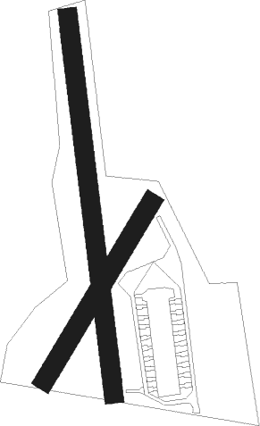
Runway info
Runway 04 / 22  | ||
| length | 238m (781ft) | |
| bearing | 42° / 222° | |
| width | 22m (72ft) | |
| surface | dirt | |
| displ threshold | 17m (56ft) / 10m (33ft) | |
| Runway 18 / 36 | ||
| length | 437m (1434ft) | |
| bearing | 177° / 357° | |
| width | 22m (71ft) | |
| surface | dirt | |
| displ threshold | 22m (72ft) / 20m (66ft) | |
Nearby beacons
| code | identifier | dist | bearing | frequency |
|---|---|---|---|---|
| EEC | EL COPERO (SEVILLA) NDB | 27 | 84° | 327 |
| JER | JEREZ NDB | 36.4 | 128° | 433 |
| JRZ | JEREZ VOR/DME | 36.9 | 129° | 113 |
| AOG | ROTA TACAN | 37.9 | 161° | 108.60 |
| SPP | SEVILLE NDB | 37.9 | 78° | 420 |
| SVL | SEVILLE VOR/DME | 39.6 | 78° | 113.70 |
| MRN | MORON (SEVILLE) VOR/DME | 45.4 | 95° | 115.50 |
Disclaimer
The information on this website is not for real aviation. Use this data with the X-Plane flight simulator only! Data taken with kind consent from X-Plane 12 source code and data files. Content is subject to change without notice.