Sallent
Airport details
| Country | Spain |
| State | Catalonia |
| Region | |
| Airspace | Barcelona Ctr |
| Municipality | Sant Fruitós de Bages |
| Elevation | 890ft (271m) |
| Timezone | GMT +1 |
| Coordinates | 41.77644, 1.88811 |
| Magnetic var | |
| Type | land |
| Available since | X-Plane v10.40 |
| ICAO code | XLE0012 |
| IATA code | n/a |
| FAA code | n/a |
Communication
| Sallent unnamed entity | 130.125 |
Nearby Points of Interest:
Casa Gran del Pont de Cabrianes
-Habitatges de la Fàbrica del Pont de Cabrianes
-Mas de la Colònia Galobard
-Fàbrica de farines La Victòria
-Torre de Sant Martí
-Pont Vell de Navarcles
-La Fàbrica del Pont Vell
-Cal Berenguer de Cabrianes
-Can Sala
-Mas Aguilar
-Ca la Xica
-La Màquina de Batre
-Ca la Madrona (Navarcles)
-Ajuntament de Navarcles
-Tanatori de Navarcles
-Lintel house Plaza General Prim, 2
-Carrer Padró
-font de la carretera de Vic
-Church of Saint Fructuosus of Bages
-La Creueta de Navarcles
-Les Tàpies (Calders)
-l'Illa
-El Solervicens
-L'Angla
-Celler del Sindicat Agrícola de Santpedor
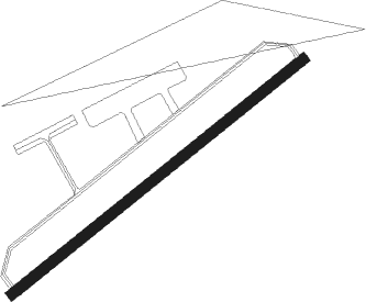
Runway info
| Runway 05 / 23 | ||
| length | 401m (1316ft) | |
| bearing | 63° / 243° | |
| width | 11m (36ft) | |
| surface | asphalt | |
Nearby beacons
| code | identifier | dist | bearing | frequency |
|---|---|---|---|---|
| SLL | SABADELL VOR/DME | 18.3 | 139° | 112 |
| BCN | BARCELONA VOR/DME | 29.8 | 155° | 116.70 |
| VLA | VILLAFRANCA VOR/DME | 30.2 | 218° | 113.15 |
| PRA | EL PRAT VOR/DME | 30.8 | 159° | 114.30 |
| CLE | CALELLA VOR/DME | 34.4 | 100° | 115.35 |
| VNV | VILLANUEVA NDB | 34.9 | 198° | 380 |
| G | GIRONA NDB | 40.4 | 80° | 330 |
| GIR | GERONA (GIRONA) VOR/DME | 40.6 | 80° | 114.10 |
| SAL | SAINTE LEOCADIE NDB | 40.6 | 11° | 418 |
| GRN | GERONA (GIRONA) NDB | 43.7 | 75° | 412 |
| RES | REUS VOR/DME | 49.5 | 229° | 114.20 |
| RUS | REUS NDB | 50.4 | 230° | 424 |
| PPG | PERPIGNAN RIVESALTES VOR/DME | 72.8 | 45° | 117.20 |
Disclaimer
The information on this website is not for real aviation. Use this data with the X-Plane flight simulator only! Data taken with kind consent from X-Plane 12 source code and data files. Content is subject to change without notice.