Stenay - Beauclair
Airport details
| Country | France |
| State | Grand Est |
| Region | |
| Airspace | Paris Ctr |
| Municipality | Tailly |
| Elevation | 597ft (182m) |
| Timezone | GMT +1 |
| Coordinates | 49.46031, 5.10825 |
| Magnetic var | |
| Type | land |
| Available since | X-Plane v10.40 |
| ICAO code | XLF000D |
| IATA code | n/a |
| FAA code | n/a |
Communication
Nearby Points of Interest:
Fanum de Mouzon
-Maisons espagnoles de Mouzon
-Château-ferme de Brieulles-sur-Bar
-Fortifications de Carignan
-Château d'Auflance
-Château de Montvillers
-Haut-fourneau de Vendresse
-Butte de Vauquois
-Manufacture de draps Cunin-Gridaine
-Couvent des Capucins irlandais
-Château-Bas de Sedan
-Hôtel de ville de Sedan
-Abbaye de La Chalade
-Forge de Vrigne-aux-Bois
-Château de Lumes
-Immeuble, 27 rue de la Paix
-Abbaye Saint-Vanne de Verdun
-Sous-préfecture de Verdun
-Porte Châtel
-Maison du Pape Jules II
-Immeuble Noguez
-Pont-écluse Saint-Amand de Verdun
-Verdun Town Hall
-Remparts de Verdun
-Tombeau du Géant
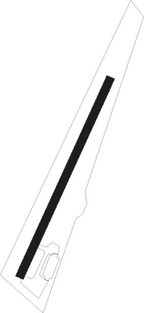
Runway info
| Runway 03 / 21 | ||
| length | 300m (984ft) | |
| bearing | 40° / 220° | |
| width | 12m (39ft) | |
| surface | grass | |
Nearby beacons
| code | identifier | dist | bearing | frequency |
|---|---|---|---|---|
| MMD | MONTMEDY VOR | 4.1 | 167° | 109.40 |
| ETN | ETAIN NDB | 26.1 | 112° | 410 |
| WLU | LUXEMBOURG NDB | 37.4 | 84° | 346 |
| BFS | FLORENNES TACAN | 50.1 | 330° | 111.50 |
| SDI | SAINT DIZIER ROBINSON TACAN | 50.1 | 195° | 114 |
| CVT | CHALONS NDB | 52.3 | 228° | 347 |
| CAV | CHALONS VOR/DME | 55.6 | 235° | 111.65 |
| NAY | NANCY OCHEY TACAN | 62.2 | 136° | 116.80 |
| GSY | GOSLY (CHARLEROI) VOR/DME | 64.9 | 326° | 115.70 |
Disclaimer
The information on this website is not for real aviation. Use this data with the X-Plane flight simulator only! Data taken with kind consent from X-Plane 12 source code and data files. Content is subject to change without notice.